MyTopo
Chelsea NW Montana US Topo Map
Couldn't load pickup availability
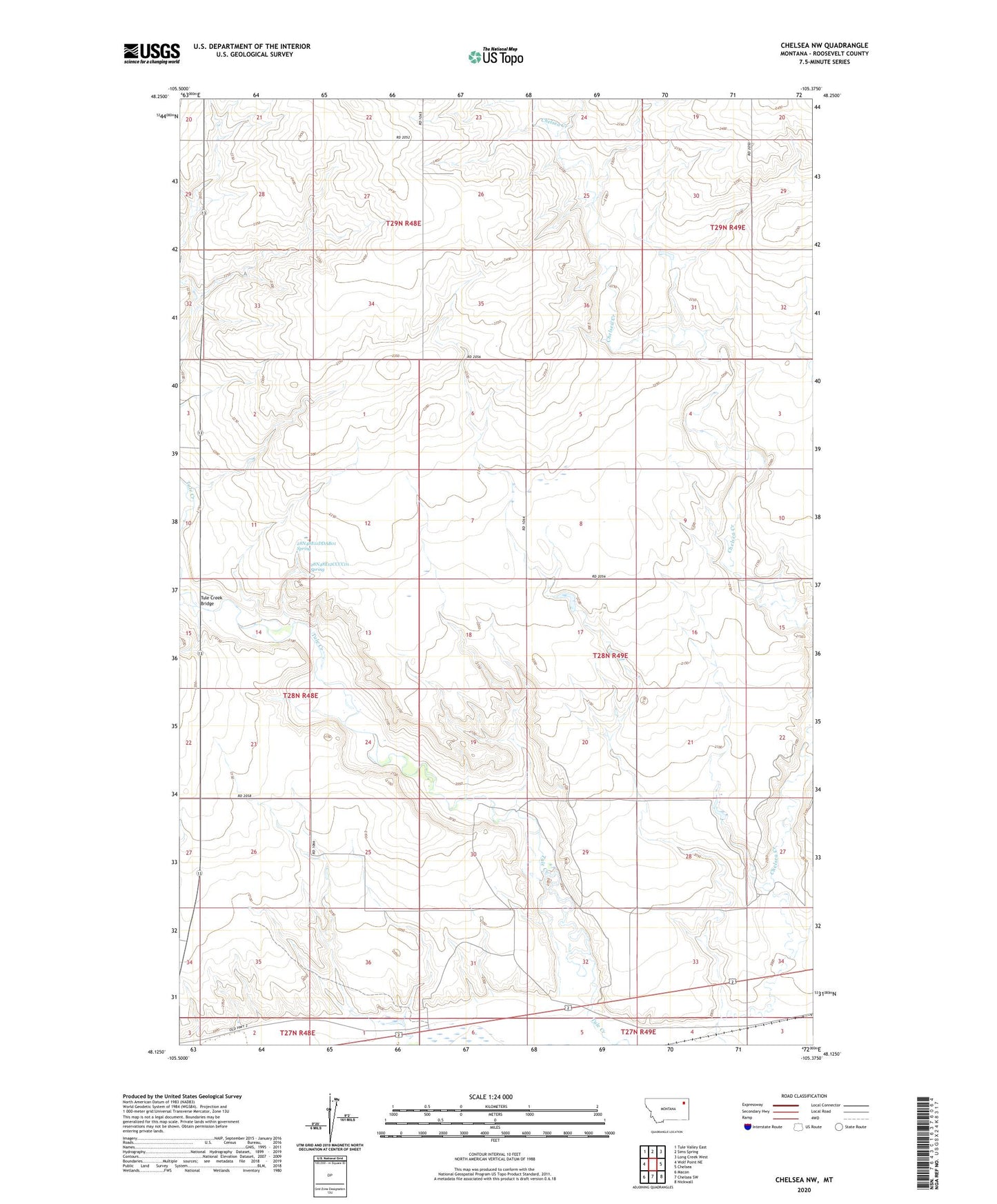
2024 topographic map quadrangle Chelsea NW in the state of Montana. Scale: 1:24000. Based on the newly updated USGS 7.5' US Topo map series, this map is in the following counties: Roosevelt. The map contains contour data, water features, and other items you are used to seeing on USGS maps, but also has updated roads and other features. This is the next generation of topographic maps. Printed on high-quality waterproof paper with UV fade-resistant inks.
Quads adjacent to this one:
West: Wolf Point NE
Northwest: Tule Valley East
North: Sims Spring
Northeast: Long Creek West
East: Chelsea
Southeast: Nickwall
South: Chelsea SW
Southwest: Macon
This map covers the same area as the classic USGS quad with code o48105b4.
Contains the following named places: 27N48E02BA__01 Well, 27N49E05AB__01 Well, 28N48E01DA__01 Well, 28N48E11DDAB01 Spring, 28N48E12CCCC01 Spring, 28N48E25CB__01 Well, 28N48E25CBBA01 Well, 28N48E36DD__01 Well, 28N48E36DD__02 Well, 28N49E15BACA01 Well, 28N49E16BA__01 Well, 28N49E16BA__02 Well, 28N49E17AA__01 Well, 28N49E17AA__02 Well, 28N49E18BD__01 Well, 28N49E33DD__01 Well, 28N49E34BC__01 Well, 28N49E34DC__01 Well, 29N48E22DDDD01 Well, Anderson Reservoir Number 1 Dam, Divide School, L Sayer-Magdelena Dam, South School, Tule Creek Bridge