MyTopo
Lost Trail Pass Montana US Topo Map
Couldn't load pickup availability
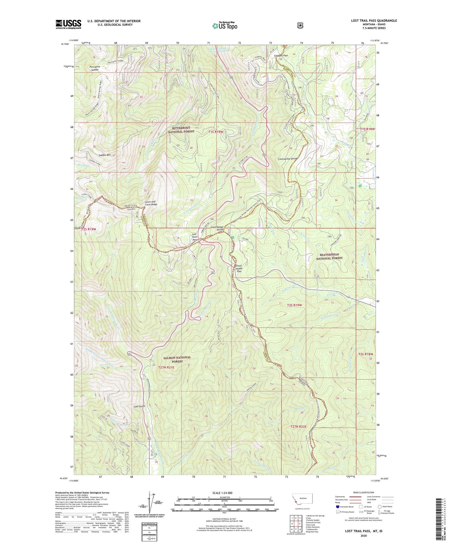
2020 topographic map quadrangle Lost Trail Pass in the states of Idaho, Montana. Scale: 1:24000. Based on the newly updated USGS 7.5' US Topo map series, this map is in the following counties: Ravalli, Lemhi, Beaverhead. The map contains contour data, water features, and other items you are used to seeing on USGS maps, but also has updated roads and other features. This is the next generation of topographic maps. Printed on high-quality waterproof paper with UV fade-resistant inks.
Quads adjacent to this one:
West: Overwhich Falls
Northwest: Medicine Hot Springs
North: Sula
Northeast: Schultz Saddle
East: Elk Creek
Southeast: Big Hole Pass
South: Gibbonsville
Southwest: Allan Mountain
Contains the following named places: Anderson Creek, B-2 Ski Trail, Big Hole National Recreation Trail, Chicken Out Ski Trail, Chief Joseph Pass, Cool Gulch, Drifter Ski Trail, East Fork Pierce Creek, Far Out Ski Trail, Gallogly Hot Springs, Gallogly Spring, Gibbons Pass, Hideout Ski Trail, Hogans Guard Station, Lewis and Clark Ridge, Lightning Ski Trail, Little Moose Creek, Lost Trail Pass, Lost Trail Pass Picnic Area, Lost Trail Powder Mountain, Lost Trail Sports Area, Lost Trail Sprots Area, Meadow Run Ski Trail, Meadow Trail Ski Trail, Moose Creek, North Bowl Ski Trail, North Face Ski Trail, Porcupine Saddle, Porcupine Saddle Trailhead, Powder Bowl Ski Trail, Prairie Creek, Richardson Creek, Saddle Mountain, Saddle Mountain Fire Area Poin of Interest, Salmon Ski Trail, Scooter Creek, South Face Ski Trail, Southern Comfort Ski Trail, Speedway Ski Trail, State Creek, Thunder Ski Trail, Upper Far Out Ski Trail, West Fork North Fork Salmon River, West Meadow Ski Trail