MyTopo
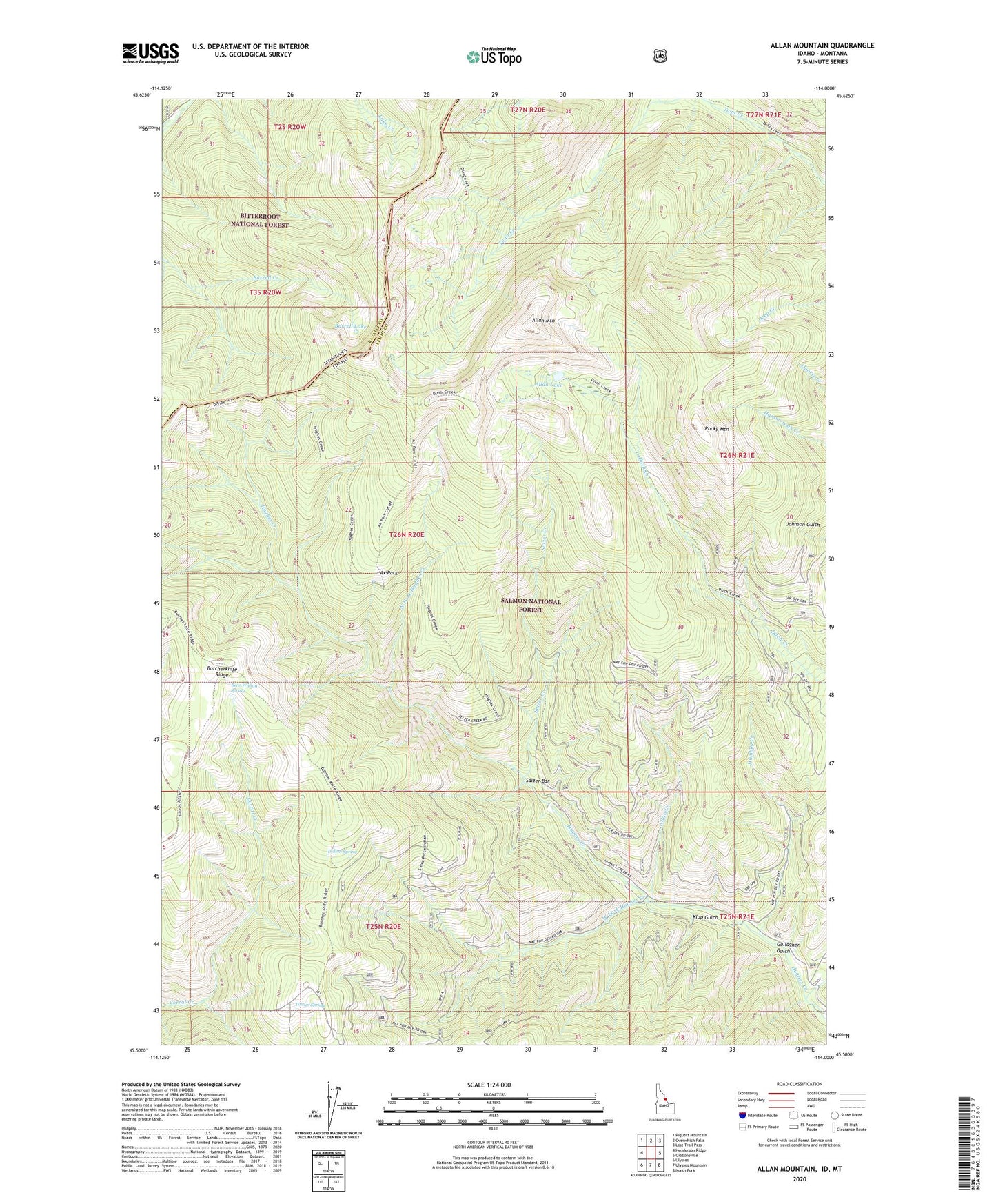
Allan Mountain Idaho US Topo Map
Couldn't load pickup availability
Also explore the Allan Mountain Forest Service Topo of this same quad for updated USFS data
2024 topographic map quadrangle Allan Mountain in the states of Idaho, Montana. Scale: 1:24000. Based on the newly updated USGS 7.5' US Topo map series, this map is in the following counties: Lemhi, Ravalli. The map contains contour data, water features, and other items you are used to seeing on USGS maps, but also has updated roads and other features. This is the next generation of topographic maps. Printed on high-quality waterproof paper with UV fade-resistant inks.
Quads adjacent to this one:
West: Henderson Ridge
Northwest: Piquett Mountain
North: Overwhich Falls
Northeast: Lost Trail Pass
East: Gibbonsville
Southeast: North Fork
South: Ulysses Mountain
Southwest: Ulysses
Contains the following named places: Allan Creek, Allan Lake, Allan Mountain, Ax Park, Ax Park Way, Bear Wallow Spring, Burrell Lake, Butcherknife Ridge, Ditch Creek, Divide Trail, Gallagher Gulch, Humbug Creek, Indian Spring, Klop Gulch, North Fork Hughes Creek, Rocky Mountain, Salzer Bar, Salzer Creek, Tincup Spring, West Fork Hughes Creek, ZIP Code: 83463