MyTopo
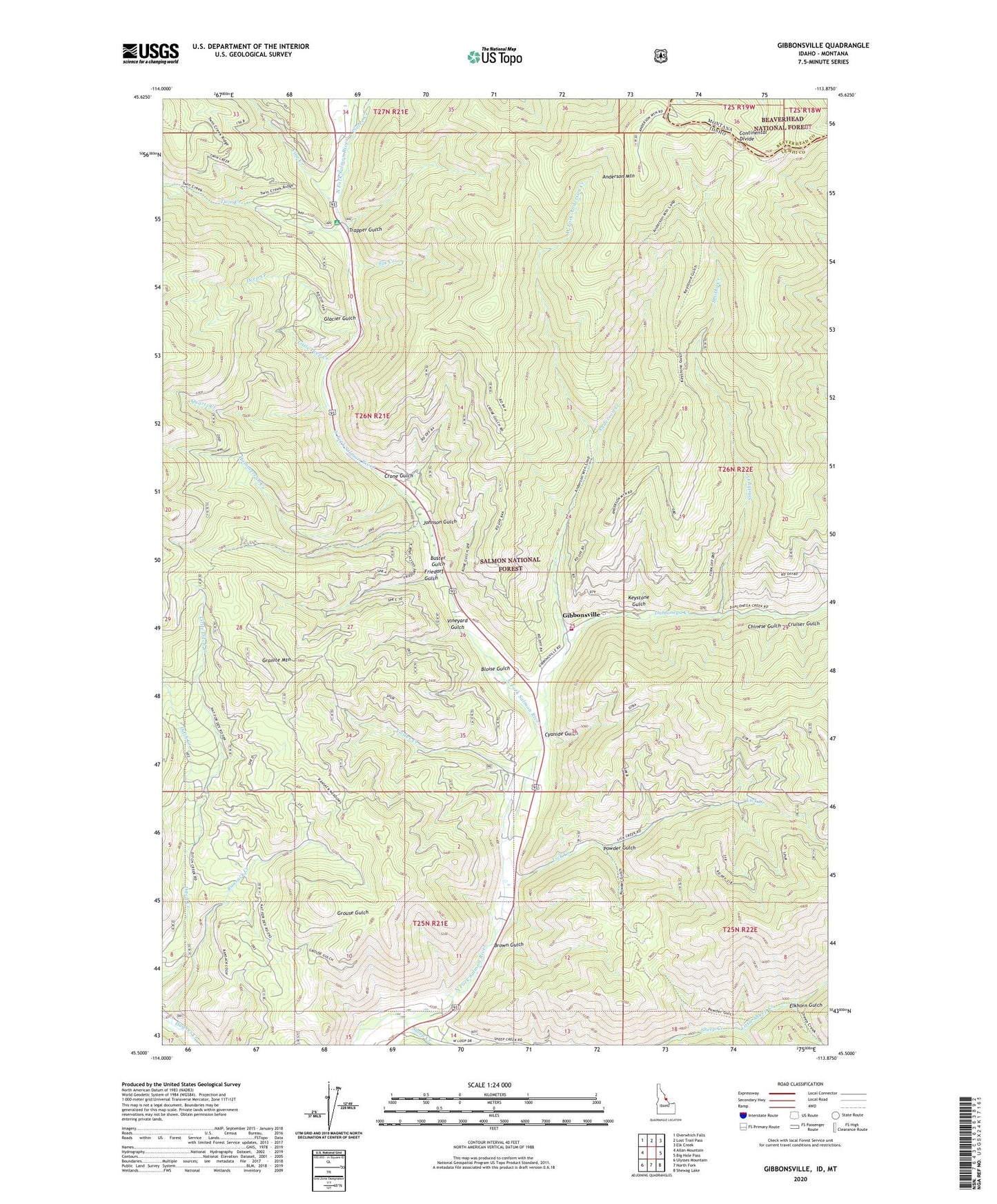
Gibbonsville Idaho US Topo Map
Couldn't load pickup availability
Also explore the Gibbonsville Forest Service Topo of this same quad for updated USFS data
2024 topographic map quadrangle Gibbonsville in the state of Idaho. Scale: 1:24000. Based on the newly updated USGS 7.5' US Topo map series, this map is in the following counties: Lemhi, Beaverhead. The map contains contour data, water features, and other items you are used to seeing on USGS maps, but also has updated roads and other features. This is the next generation of topographic maps. Printed on high-quality waterproof paper with UV fade-resistant inks.
Quads adjacent to this one:
West: Allan Mountain
Northwest: Overwhich Falls
North: Lost Trail Pass
Northeast: Elk Creek
East: Big Hole Pass
Southeast: Shewag Lake
South: North Fork
Southwest: Ulysses Mountain
Contains the following named places: Anderson Creek, Anderson Mountain, Bloise Gulch, Brown Gulch, Buster Gulch, Chinese Gulch, Crone Gulch, Cruiser Gulch, Cyanide Gulch, Dahlonega Creek, Deep Creek, Elk Creek, Elkhorn Gulch, Friedorf Gulch, Gibbonsville, Gibbonsville Cemetery, Gibbonsville Volunteer Fire Department Station 1, Glacier Gulch, Granite Mountain, Granite Mountain Guard Station, Hammerean Creek, Johnson Gulch, Keystone Gulch, Lick Creek, Little Deep Creek, Little Ditch Creek, Little Sheep Creek, Pierce Creek, Powder Gulch, Quartz Creek, Ransack Creek, Smithy Creek, Trapper Gulch, Twin Creek, Twin Creek Campground, Vine Creek, Vineyard Gulch, Votler Creek, West Fork Anderson Creek