MyTopo
Madison Plateau Montana US Topo Map
Couldn't load pickup availability
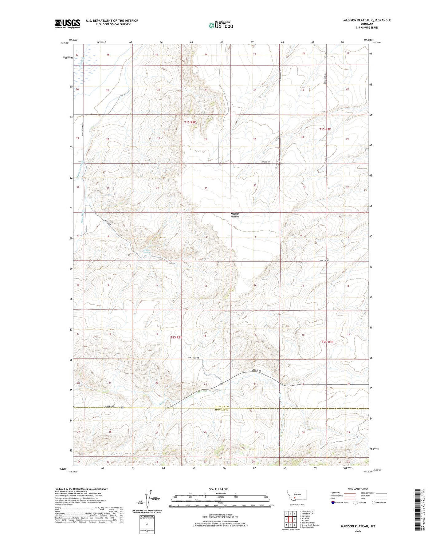
2020 topographic map quadrangle Madison Plateau in the state of Montana. Scale: 1:24000. Based on the newly updated USGS 7.5' US Topo map series, this map is in the following counties: Gallatin, Madison. The map contains contour data, water features, and other items you are used to seeing on USGS maps, but also has updated roads and other features. This is the next generation of topographic maps. Printed on high-quality waterproof paper with UV fade-resistant inks.
Quads adjacent to this one:
West: Norris NE
Northwest: Three Forks SE
North: Manhattan SW
Northeast: Manhattan
East: Anceney
Southeast: Ruby Mountain
South: Cherry Creek Canyon
Southwest: Bear Trap Creek
Contains the following named places: 01S02E16DDA_01 Well, 01S02E21DBDB01 Well, 01S02E22BCBC01 Well, 01S02E22BCCB01 Well, 01S02E22CCDA01 Well, 01S02E23BCBC01 Well, 01S02E29AAC_01 Well, 01S02E29DDDB01 Well, 01S02E35DA__01 Well, 01S03E18DA__01 Well, 02S02E01DD__01 Well, 02S03E06DA__01 Well, 02S03E06DACD01 Well, 02S03E07AA__01 Well, 02S03E19ACBC01 Well, 02S03E19BDAB01 Well, Hyde Post Office, Jorgenson Ditch, Madison Plateau, Sloan Ditch, Sloan Ranch, Upper Madison School, Willow Springs, Windville Post Office