MyTopo
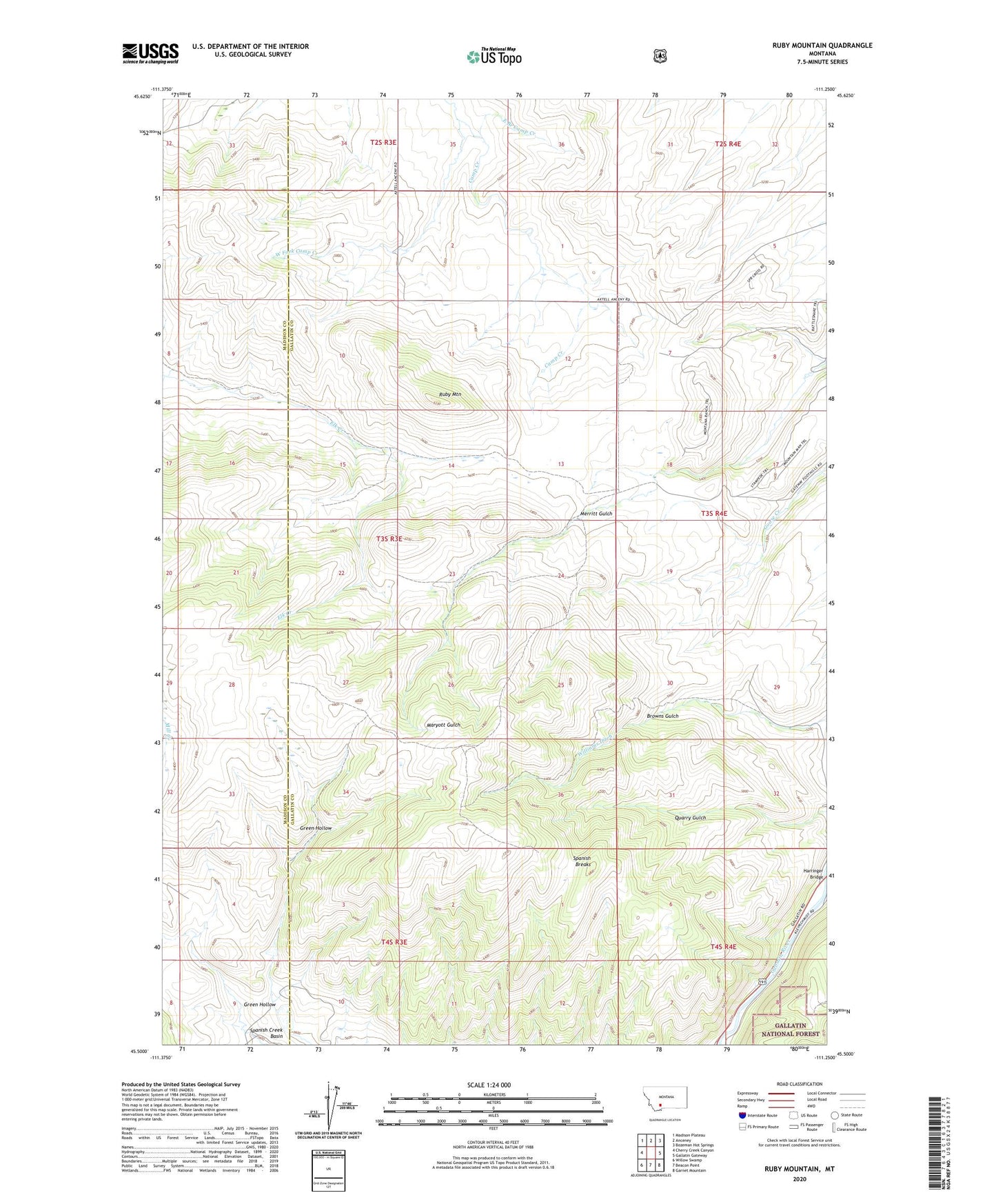
Ruby Mountain Montana US Topo Map
Couldn't load pickup availability
Also explore the Ruby Mountain Forest Service Topo of this same quad for updated USFS data
2024 topographic map quadrangle Ruby Mountain in the state of Montana. Scale: 1:24000. Based on the newly updated USGS 7.5' US Topo map series, this map is in the following counties: Gallatin, Madison. The map contains contour data, water features, and other items you are used to seeing on USGS maps, but also has updated roads and other features. This is the next generation of topographic maps. Printed on high-quality waterproof paper with UV fade-resistant inks.
Quads adjacent to this one:
West: Cherry Creek Canyon
Northwest: Madison Plateau
North: Anceney
Northeast: Bozeman Hot Springs
East: Gallatin Gateway
Southeast: Garnet Mountain
South: Beacon Point
Southwest: Willow Swamp
This map covers the same area as the classic USGS quad with code o45111e3.
Contains the following named places: 02S03E34CA__01 Well, 02S03E35AC__01 Well, 03S04E08AD__01 Well, Bozeman Corundum Mine, East Branch Camp Creek, Elk Creek, Elk Creek Corundum Mine, Green Hollow, Harmon School, Harringer Bridge, Kirk Wildlife Refuge Fishing Access Site, Quarry Gulch, Ruby Mountain, Spanish Breaks, Spanish Creek Basin, West Fork Camp Creek