MyTopo
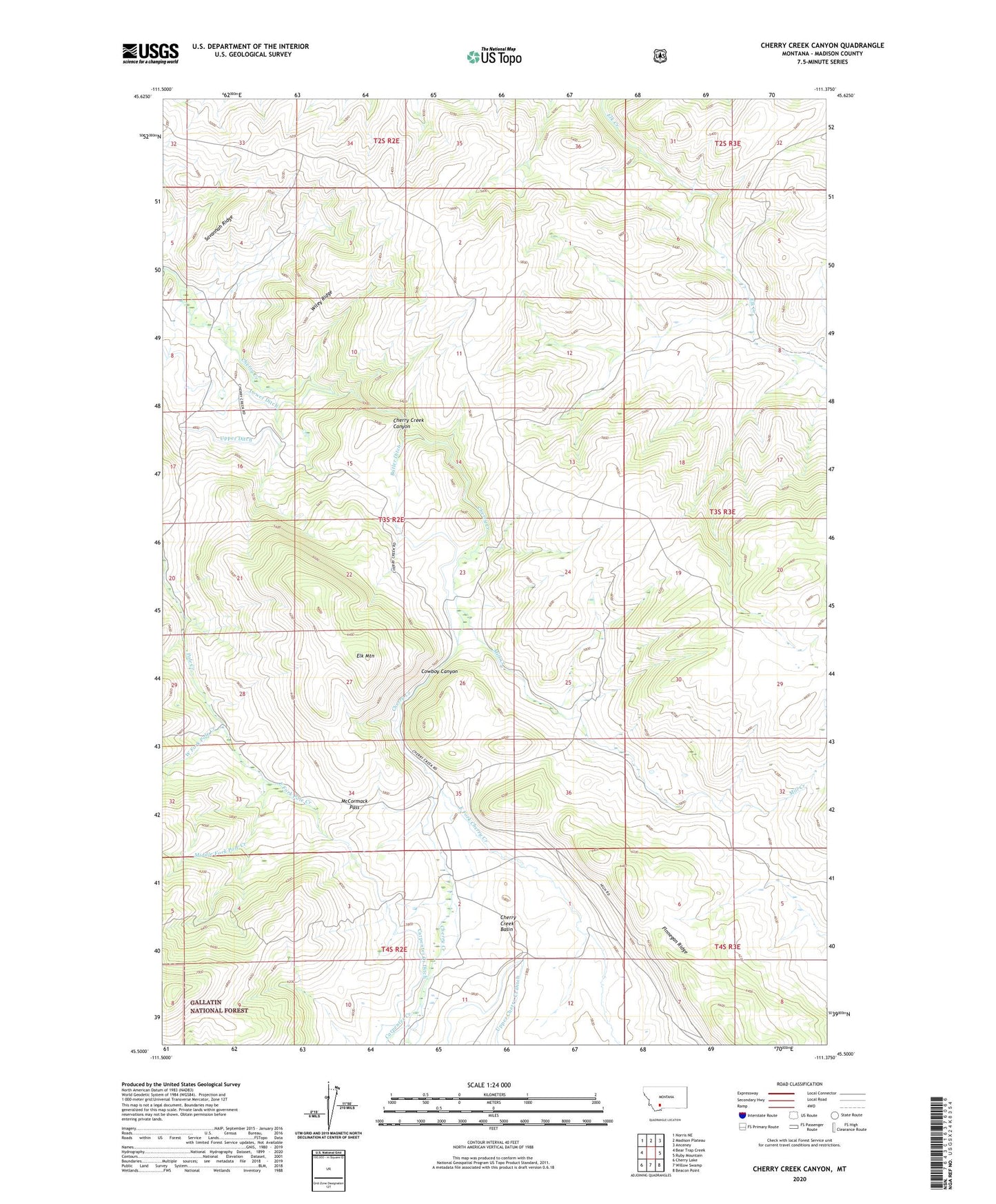
Cherry Creek Canyon Montana US Topo Map
Couldn't load pickup availability
Also explore the Cherry Creek Canyon Forest Service Topo of this same quad for updated USFS data
2024 topographic map quadrangle Cherry Creek Canyon in the state of Montana. Scale: 1:24000. Based on the newly updated USGS 7.5' US Topo map series, this map is in the following counties: Madison. The map contains contour data, water features, and other items you are used to seeing on USGS maps, but also has updated roads and other features. This is the next generation of topographic maps. Printed on high-quality waterproof paper with UV fade-resistant inks.
Quads adjacent to this one:
West: Bear Trap Creek
Northwest: Norris NE
North: Madison Plateau
Northeast: Anceney
East: Ruby Mountain
Southeast: Beacon Point
South: Willow Swamp
Southwest: Cherry Lake
This map covers the same area as the classic USGS quad with code o45111e4.
Contains the following named places: Butler Ditch, Butler Ranch, Carpenter Creek, Carpenter Creek Ditch, Cherry Creek Basin, Cherry Creek Canyon, Cooper Mine, Cow Camp, Cowboy Canyon, East Fork Cherry Creek, East Fork Pole Creek, Elk Mountain, Finnegan Ridge, Havana, Havana Post Office, Home Ranch, Lower Ditch, McCormack Pass, Middle Fork Pole Creek, Mill Creek, Nome Ranch, Savannah Ridge, Turner Ranch Mine, Upper Cherry Creek Ditch, Upper Ditch, West Fork Pole Creek, Wiley Ridge