MyTopo
McKenzie Creek Montana US Topo Map
Couldn't load pickup availability
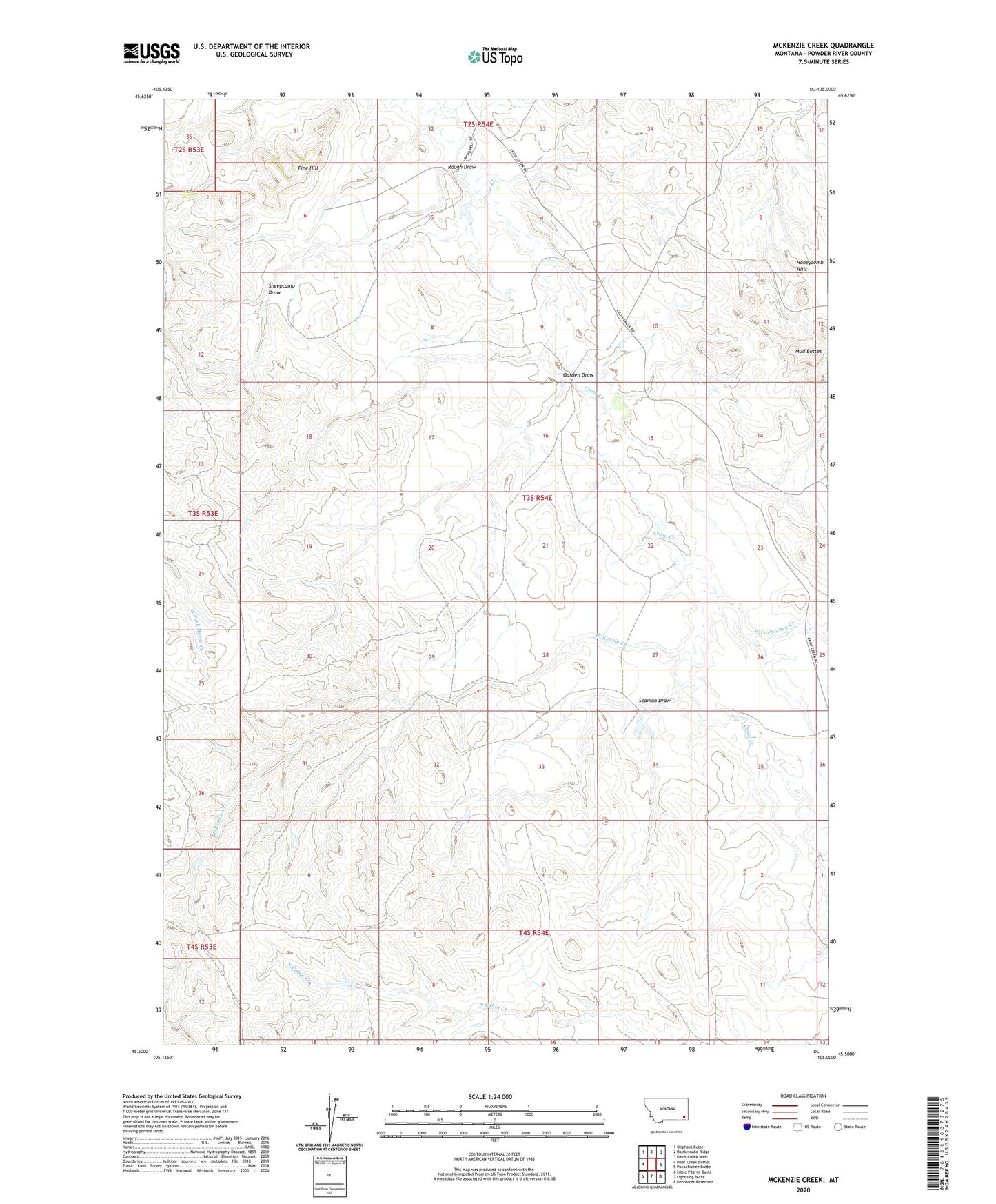
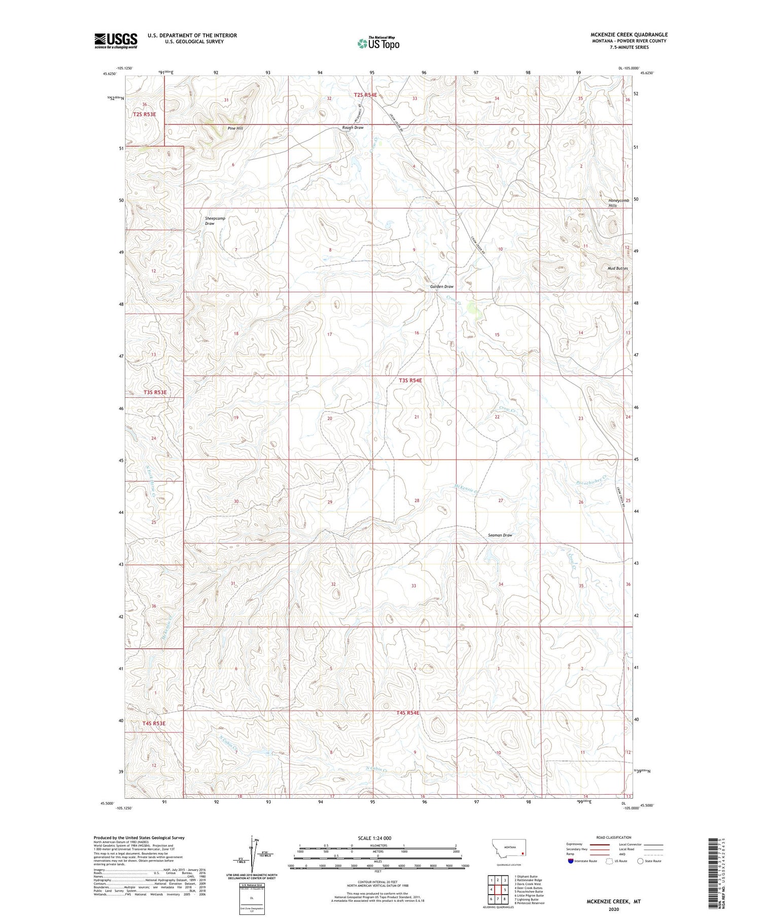
2020 topographic map quadrangle McKenzie Creek in the state of Montana. Scale: 1:24000. Based on the newly updated USGS 7.5' US Topo map series, this map is in the following counties: Powder River. The map contains contour data, water features, and other items you are used to seeing on USGS maps, but also has updated roads and other features. This is the next generation of topographic maps. Printed on high-quality waterproof paper with UV fade-resistant inks.
Quads adjacent to this one:
West: Deer Creek Buttes
Northwest: Oliphant Butte
North: Rattlesnake Ridge
Northeast: Davis Creek West
East: Pocochichee Butte
Southeast: Pentecost Reservoir
South: Lightning Butte
Southwest: Little Pilgrim Butte
Contains the following named places: 02S54E32CDB_01 Well, 02S54E35ADD_01 Well, 03S54E04DC__01 Well, 03S54E09DCC_02 Well, 03S54E20BDDB01 Well, 03S54E34BBDD01 Well, Garden Draw, Honeycomb Hills, McKenzie Creek, Mud Buttes, Pine Hill, Pocochichee Creek, Rough Draw, Seaman Draw, Sheepcamp Draw