MyTopo
McRae Springs Montana US Topo Map
Couldn't load pickup availability
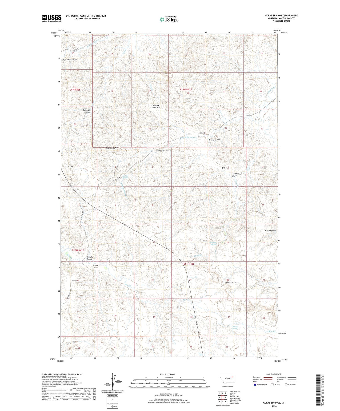
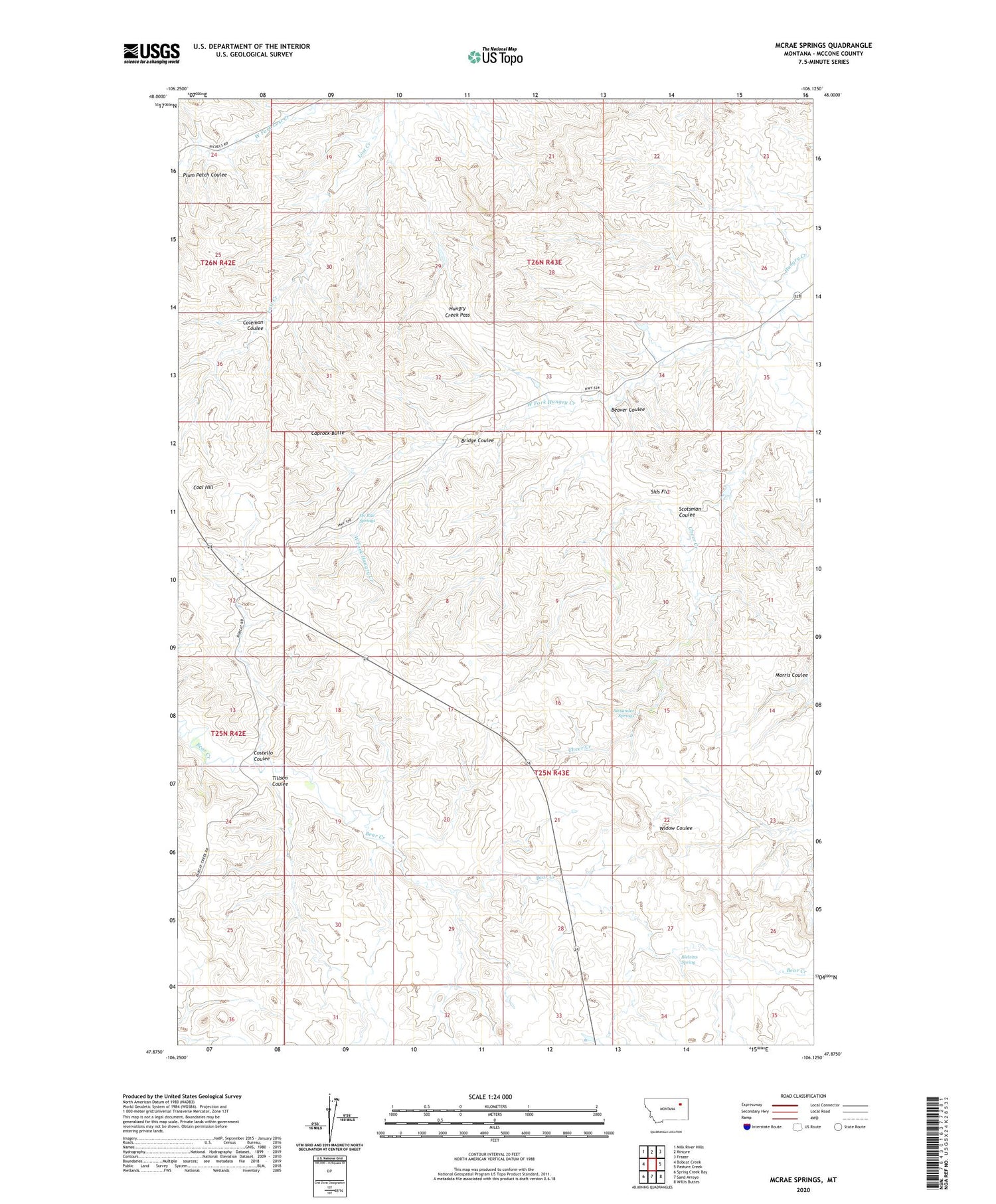
2020 topographic map quadrangle McRae Springs in the state of Montana. Scale: 1:24000. Based on the newly updated USGS 7.5' US Topo map series, this map is in the following counties: McCone. The map contains contour data, water features, and other items you are used to seeing on USGS maps, but also has updated roads and other features. This is the next generation of topographic maps. Printed on high-quality waterproof paper with UV fade-resistant inks.
Quads adjacent to this one:
West: Bobcat Creek
Northwest: Milk River Hills
North: Kintyre
Northeast: Frazer
East: Pasture Creek
Southeast: Willis Buttes
South: Sand Arroyo
Southwest: Spring Creek Bay
Contains the following named places: Alexander Springs, Beaver Coulee, Bielvins Spring, Bridge Coulee, Caprock Butte, Cheer Creek, Coal Hill, Coleman Coulee, Costello Coulee, Durham Coulee, Hungry Creek Pass, Mc Rae Springs, Morris Coulee, Scotsman Coulee, Sids Flat, Tillson Coulee, West Fork Hungry Creek