MyTopo
Kintyre Montana US Topo Map
Couldn't load pickup availability
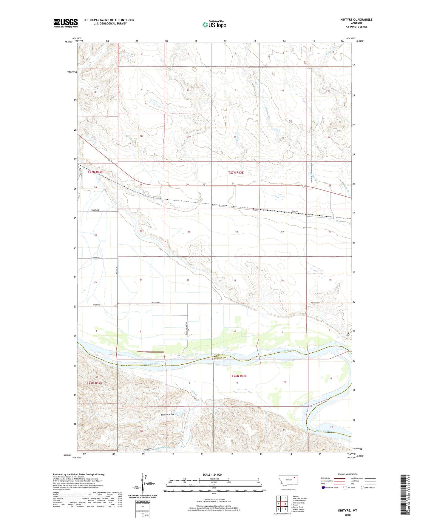
2024 topographic map quadrangle Kintyre in the state of Montana. Scale: 1:24000. Based on the newly updated USGS 7.5' US Topo map series, this map is in the following counties: Valley, McCone. The map contains contour data, water features, and other items you are used to seeing on USGS maps, but also has updated roads and other features. This is the next generation of topographic maps. Printed on high-quality waterproof paper with UV fade-resistant inks.
Quads adjacent to this one:
West: Milk River Hills
Northwest: Nashua
North: Milk River Coulee
Northeast: Dubbe Reservoir
East: Frazer
Southeast: Pasture Creek
South: McRae Springs
Southwest: Bobcat Creek
This map covers the same area as the classic USGS quad with code o48106a2.
Contains the following named places: 26N42E01AA__01 Well, 26N43E03BD__01 Well, 26N43E04AA__01 Well, 26N43E04AC__01 Well, 26N43E04AD__01 Well, 26N43E04AD__02 Well, 26N43E05AC__01 Well, 26N43E05CAAB01 Well, 26N43E05DB__01 Well, 26N43E06AC__01 Well, 26N43E06AC__02 Well, 26N43E06BD__01 Well, 26N43E08CBAB01 Well, 26N43E09BACD01 Well, 26N43E09BD__01 Well, 26N43E09CA__01 Well, 26N43E10BB__01 Well, 26N43E10CC__01 Well, 26N43E12BA__01 Well, 27N42E24CA__01 Well, 27N42E25AB__01 Well, 27N42E25BA__01 Well, 27N42E25CD__01 Well, 27N42E25DC__01 Well, 27N42E36BA__01 Well, 27N42E36CD__01 Well, 27N42E36DA__01 Well, 27N43E22BD__01 Well, 27N43E23CB__01 Well, 27N43E23DA__01 Well, 27N43E23DA__02 Well, 27N43E26BB__01 Well, 27N43E28AA__01 Well, 27N43E31BB__01 Well, 27N43E32BB__01 Well, 27N43E32CB__01 Well, 27N43E33CC__01 Well, 27N43E34AD__01 Well, 27N43E34BA__01 Well, Fort Dauphin, Frazer Pumping Station, Heifer Pen Dam, Kintyre, Lost Creek, Missouri Pump Canal, Sarge Coulee, West Fork Lost Creek