
MyTopo
Milk River Hills Montana US Topo Map
Couldn't load pickup availability
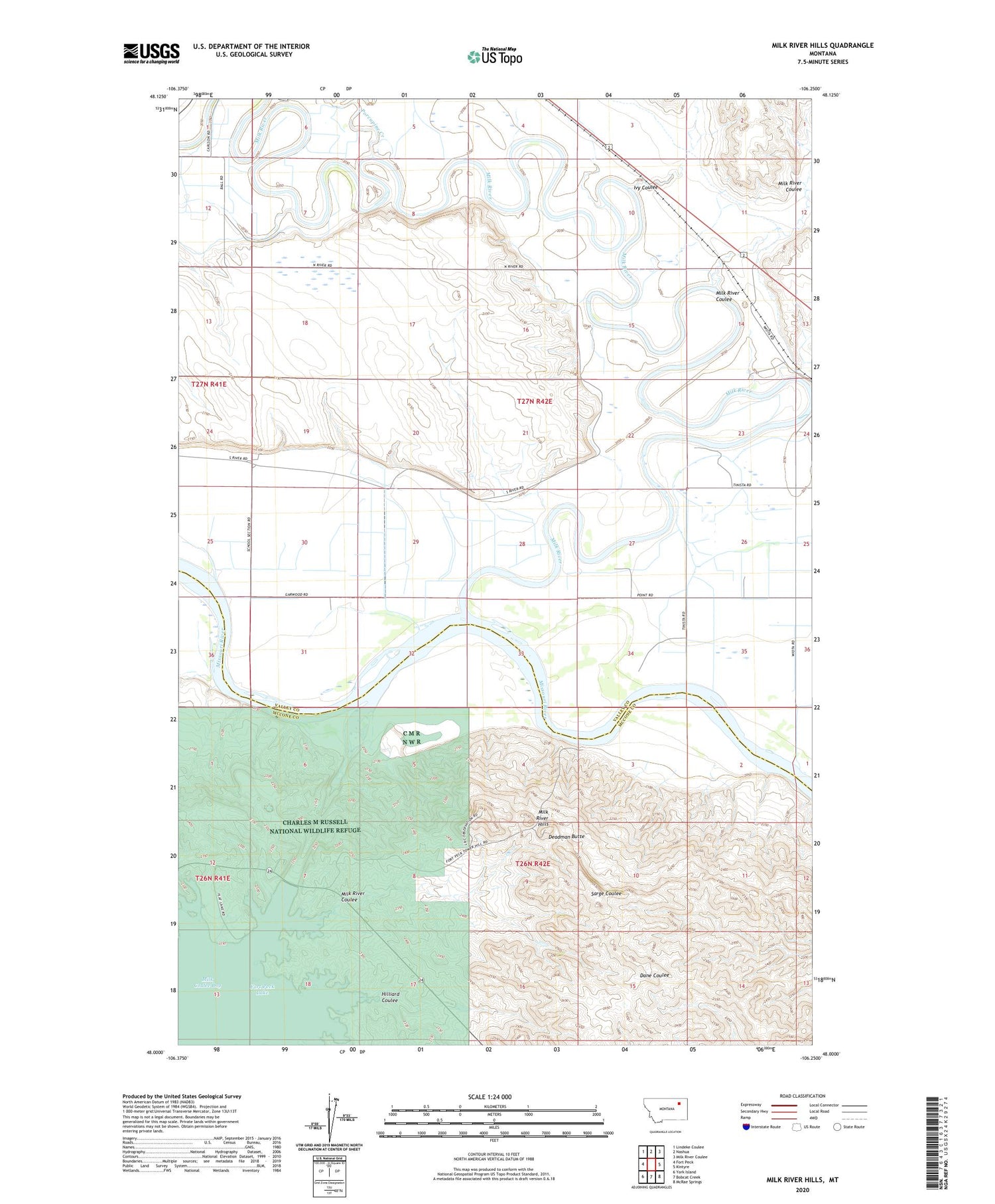
2020 topographic map quadrangle Milk River Hills in the state of Montana. Scale: 1:24000. Based on the newly updated USGS 7.5' US Topo map series, this map is in the following counties: Valley, McCone. The map contains contour data, water features, and other items you are used to seeing on USGS maps, but also has updated roads and other features. This is the next generation of topographic maps. Printed on high-quality waterproof paper with UV fade-resistant inks.
Quads adjacent to this one:
West: Fort Peck
Northwest: Lindeke Coulee
North: Nashua
Northeast: Milk River Coulee
East: Kintyre
Southeast: McRae Springs
South: Bobcat Creek
Southwest: York Island
Contains the following named places: 26N42E02AA__01 Well, 27N42E08AB__01 Well, 27N42E11CADC01 Well, 27N42E22CBDC01 Well, 27N42E24CC__01 Well, 27N42E26AAAA01 Well, 27N42E26AD__01 Well, 27N42E26BA__01 Well, 27N42E26DC__01 Well, 27N42E26DCBB01 Well, 27N42E26DD__01 Well, 27N42E27AD__01 Well, 27N42E28ABDC01 Well, 27N42E33AA__01 Well, 27N42E33CDDC01 Well, 27N42E34AA__01 Well, 27N42E34AC__01 Well, 27N42E35AA__01 Well, 27N42E35DD__01 Well, 28N42E28ABDC01 Well, Deadman Butte, Flat Lake Recreation Area, Fort Copeland, Fort Peck, Hilliard Coulee, Ivy Coulee, Milk Coulee Bay, Milk River, Milk River Coulee, Milk River Hills, Porcupine Creek, South Nashua School, Wiota, Wiota Post Office, Wiota School


