MyTopo
Ninemile Point Montana US Topo Map
Couldn't load pickup availability
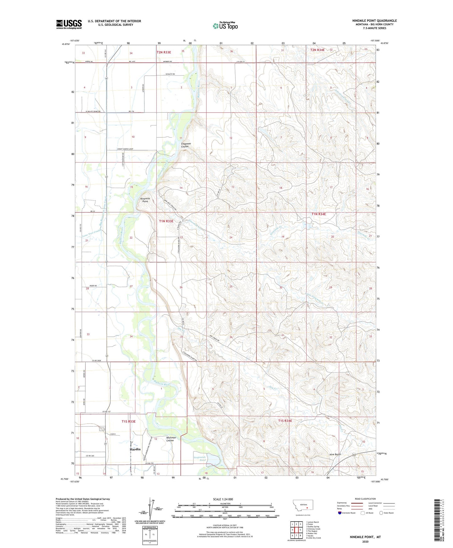
2020 topographic map quadrangle Ninemile Point in the state of Montana. Scale: 1:24000. Based on the newly updated USGS 7.5' US Topo map series, this map is in the following counties: Big Horn. The map contains contour data, water features, and other items you are used to seeing on USGS maps, but also has updated roads and other features. This is the next generation of topographic maps. Printed on high-quality waterproof paper with UV fade-resistant inks.
Quads adjacent to this one:
West: Chimney Creek
Northwest: Lemon Ranch
North: Foster
Northeast: Dudley Spring
East: The Dugout
Southeast: Little Dry Creek
South: Hardin
Southwest: Walker Hill
Contains the following named places: 01N33E16AD__01 Well, 01N33E27BBBB01 Well, 01N33E27BBBB02 Well, 01N33E28CD__01 Well, 01S33E03DDDD01 Well, 01S33E14ABBB01 Well, 02N33E35CD__01 Well, Arapooish Fishing Access Site, Arapooish Pond, Arapooish Recreation Park, Big Horn Low Line Canal, Carperville, Carperville Post Office, Chapman Coulee, Chimney Creek, Demar, Dry Creek, Fort Custer Golf Club, Grant Marsh Wildlife Management Area, Grant Marsh Wildlife Management Area Fishing Access Site, Hardin Division, Hardin KOA Campground, Hive Butte, Holly, Little Ninemile Creek, Lone Tree Coulee, Miller Ranch, Nine Mile School, Ninemile Creek, Ninemile Point, Ottum Ranch, Ottun Number 3 Dam, Whitman Coulee