MyTopo
Dudley Spring Montana US Topo Map
Couldn't load pickup availability
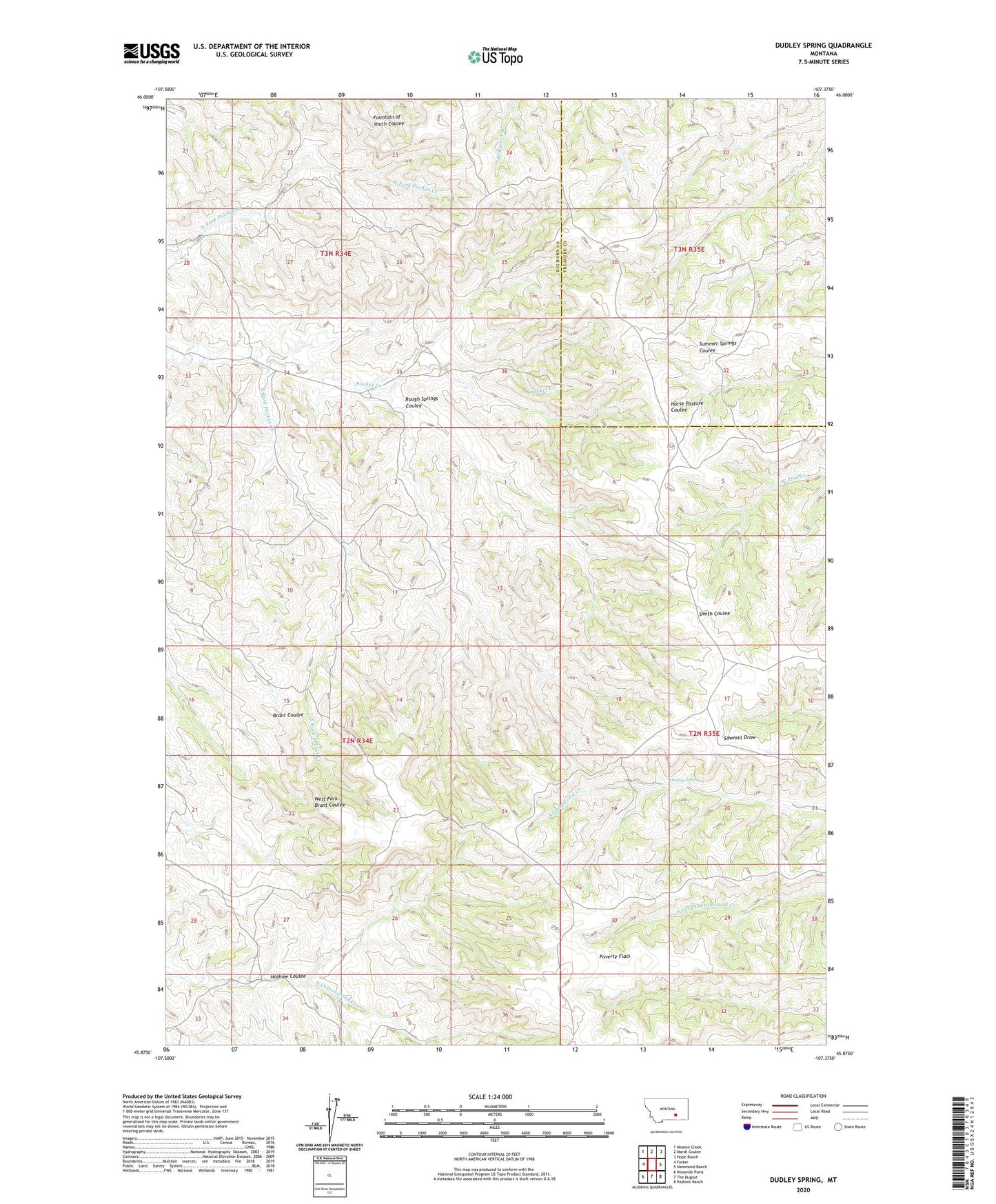
2024 topographic map quadrangle Dudley Spring in the state of Montana. Scale: 1:24000. Based on the newly updated USGS 7.5' US Topo map series, this map is in the following counties: Big Horn, Treasure. The map contains contour data, water features, and other items you are used to seeing on USGS maps, but also has updated roads and other features. This is the next generation of topographic maps. Printed on high-quality waterproof paper with UV fade-resistant inks.
Quads adjacent to this one:
West: Foster
Northwest: Mission Creek
North: Marsh Coulee
Northeast: Hope Ranch
East: Hammond Ranch
Southeast: Padlock Ranch
South: The Dugout
Southwest: Ninemile Point
This map covers the same area as the classic USGS quad with code o45107h4.
Contains the following named places: 02N34E02CACD01 Well, Dudley Spring, Hoshow Coulee, Old Ford Place, Poverty Flats, Rough Springs Coulee, South Fork Pocket Creek