MyTopo
Nyack Montana US Topo Map
Couldn't load pickup availability
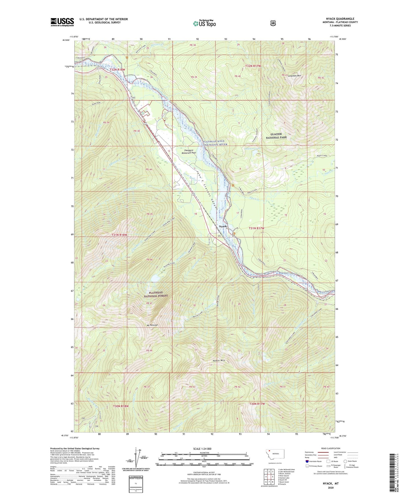
2020 topographic map quadrangle Nyack in the state of Montana. Scale: 1:24000. Based on the newly updated USGS 7.5' US Topo map series, this map is in the following counties: Flathead. The map contains contour data, water features, and other items you are used to seeing on USGS maps, but also has updated roads and other features. This is the next generation of topographic maps. Printed on high-quality waterproof paper with UV fade-resistant inks.
Quads adjacent to this one:
West: West Glacier
Northwest: Lake McDonald West
North: Lake McDonald East
Northeast: Mount Jackson
East: Stanton Lake
Southeast: Pinnacle
South: Mount Grant
Southwest: Nyack SW
Contains the following named places: Cascade Creek, Cascadilla Creek, Deerlick Creek, Flathead Wild and Scenic River, Great Bear Creek, Halfmoon Lake, Harrison Creek, Loneman Mountain, Loneman Mountain Trail, Moccasin Boat Landing, Moccasin Creek, Mount Penrose, Nyack, Nyack Creek, Nyack Mountain, Nyack Post Office, Nyack Ranger Station, Nyack School, Pyramid Creek, Red Eagle, Rescue Creek, Skiumah Creek, Wahoo Creek