MyTopo
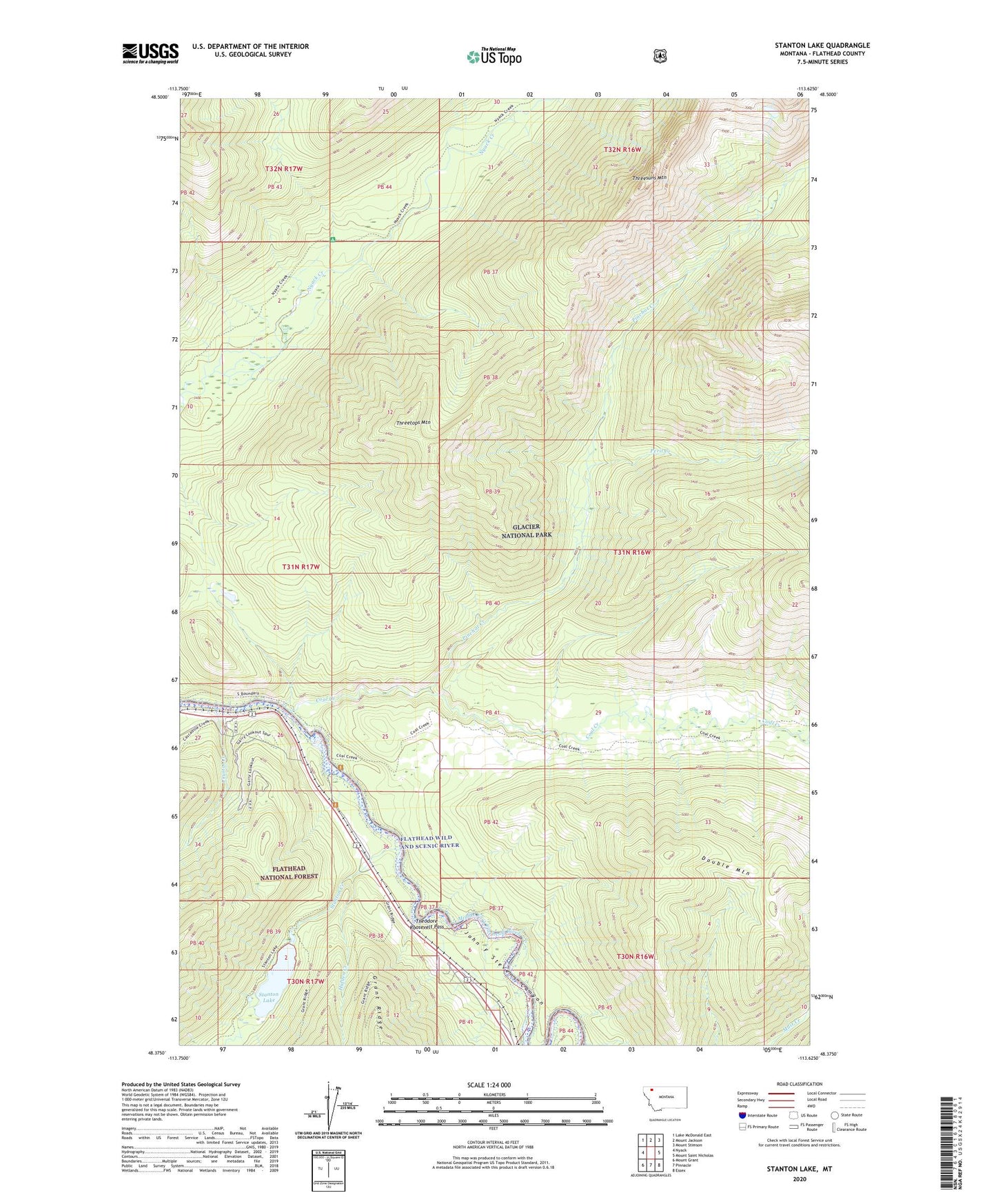
Stanton Lake Montana US Topo Map
Couldn't load pickup availability
Also explore the Stanton Lake Forest Service Topo of this same quad for updated USFS data
2024 topographic map quadrangle Stanton Lake in the state of Montana. Scale: 1:24000. Based on the newly updated USGS 7.5' US Topo map series, this map is in the following counties: Flathead. The map contains contour data, water features, and other items you are used to seeing on USGS maps, but also has updated roads and other features. This is the next generation of topographic maps. Printed on high-quality waterproof paper with UV fade-resistant inks.
Quads adjacent to this one:
West: Nyack
Northwest: Lake McDonald East
North: Mount Jackson
Northeast: Mount Stimson
East: Mount Saint Nicholas
Southeast: Essex
South: Pinnacle
Southwest: Mount Grant
This map covers the same area as the classic USGS quad with code o48113d6.
Contains the following named places: Boundary Trail, Coal Creek, Coal Creek Fire Trail, Crystal Creek, Disbrow Creek, Double Mountain, Garry Lookout Tower, Garry Post Office, Hidden Creek, Hidden Lake, Peril Creek, Pinchot Creek, Stanton Creek, Stanton Creek Lodge Campground, Stanton Lake, Threesuns Mountain, Threetops Mountain, Threetops Trail