MyTopo
Mount Jackson Montana US Topo Map
Couldn't load pickup availability
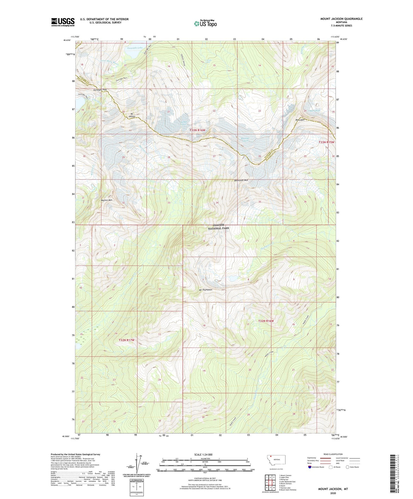
2024 topographic map quadrangle Mount Jackson in the state of Montana. Scale: 1:24000. Based on the newly updated USGS 7.5' US Topo map series, this map is in the following counties: Flathead, Glacier. The map contains contour data, water features, and other items you are used to seeing on USGS maps, but also has updated roads and other features. This is the next generation of topographic maps. Printed on high-quality waterproof paper with UV fade-resistant inks.
Quads adjacent to this one:
West: Lake McDonald East
Northwest: Mount Cannon
North: Logan Pass
Northeast: Rising Sun
East: Mount Stimson
Southeast: Mount Saint Nicholas
South: Stanton Lake
Southwest: Nyack
This map covers the same area as the classic USGS quad with code o48113e6.
Contains the following named places: Blackfoot Glacier, Blackfoot Mountain, Gunsight Lake, Gunsight Pass, Harrison Glacier, Jackson Glacier, Jackson Glacier Trail, Logan Glacier, Mount Jackson, Mount Logan, Mount Thompson, Pumpelly Glacier, Siksika Falls, Walton Mountain