MyTopo
Pike Creek Hills West Montana US Topo Map
Couldn't load pickup availability
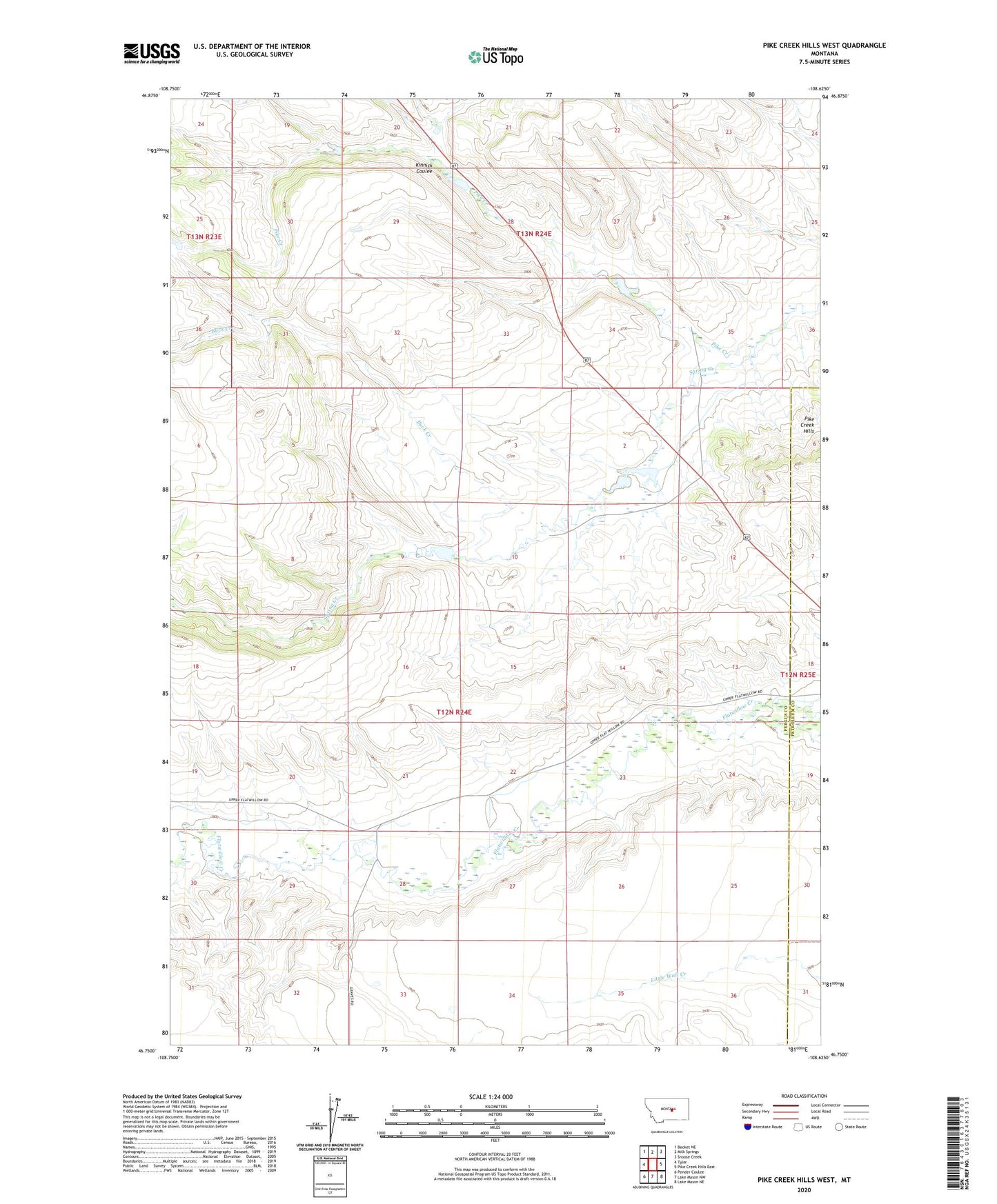
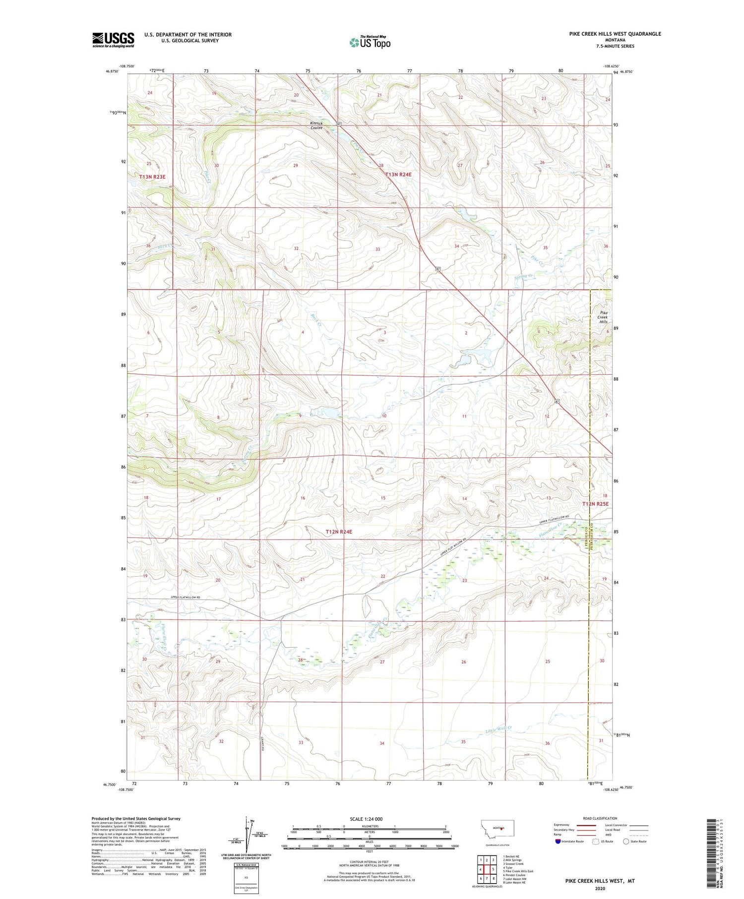
2020 topographic map quadrangle Pike Creek Hills West in the state of Montana. Scale: 1:24000. Based on the newly updated USGS 7.5' US Topo map series, this map is in the following counties: Fergus, Petroleum. The map contains contour data, water features, and other items you are used to seeing on USGS maps, but also has updated roads and other features. This is the next generation of topographic maps. Printed on high-quality waterproof paper with UV fade-resistant inks.
Quads adjacent to this one:
West: Tyler
Northwest: Becket NE
North: Milk Springs
Northeast: Snoose Creek
East: Pike Creek Hills East
Southeast: Lake Mason NE
South: Lake Mason NW
Southwest: Pender Coulee
Contains the following named places: 12N24E10ACAC01 Well, 12N24E12BB__01 Well, Buck Creek, Darrel, Darrel Post Office, Glaze School, Jesperson School, Kinnick Coulee, Mikado Post Office, Spring Creek, Spring Creek Irrigation Dam