MyTopo
Milk Springs Montana US Topo Map
Couldn't load pickup availability
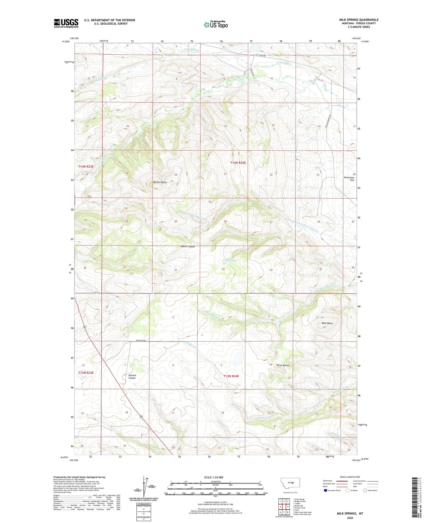
2024 topographic map quadrangle Milk Springs in the state of Montana. Scale: 1:24000. Based on the newly updated USGS 7.5' US Topo map series, this map is in the following counties: Fergus. The map contains contour data, water features, and other items you are used to seeing on USGS maps, but also has updated roads and other features. This is the next generation of topographic maps. Printed on high-quality waterproof paper with UV fade-resistant inks.
Quads adjacent to this one:
West: Becket NE
Northwest: Grass Range
North: Briggs Coulee
Northeast: Teigen
East: Snoose Creek
Southeast: Pike Creek Hills East
South: Pike Creek Hills West
Southwest: Tyler
This map covers the same area as the classic USGS quad with code o46108h6.
Contains the following named places: 14N24E10BBA_01 Well, Archer Number 2 Dam, Bald Butte, Battrick, Battrick Post Office, Battrick School, Button Butte, Hughes Junior Number 1 Dam, Kinnick School, Milk Springs, North Fork Elk Creek, Silver Brook School, Three Buttes