MyTopo
Pilot Peak Montana US Topo Map
Couldn't load pickup availability
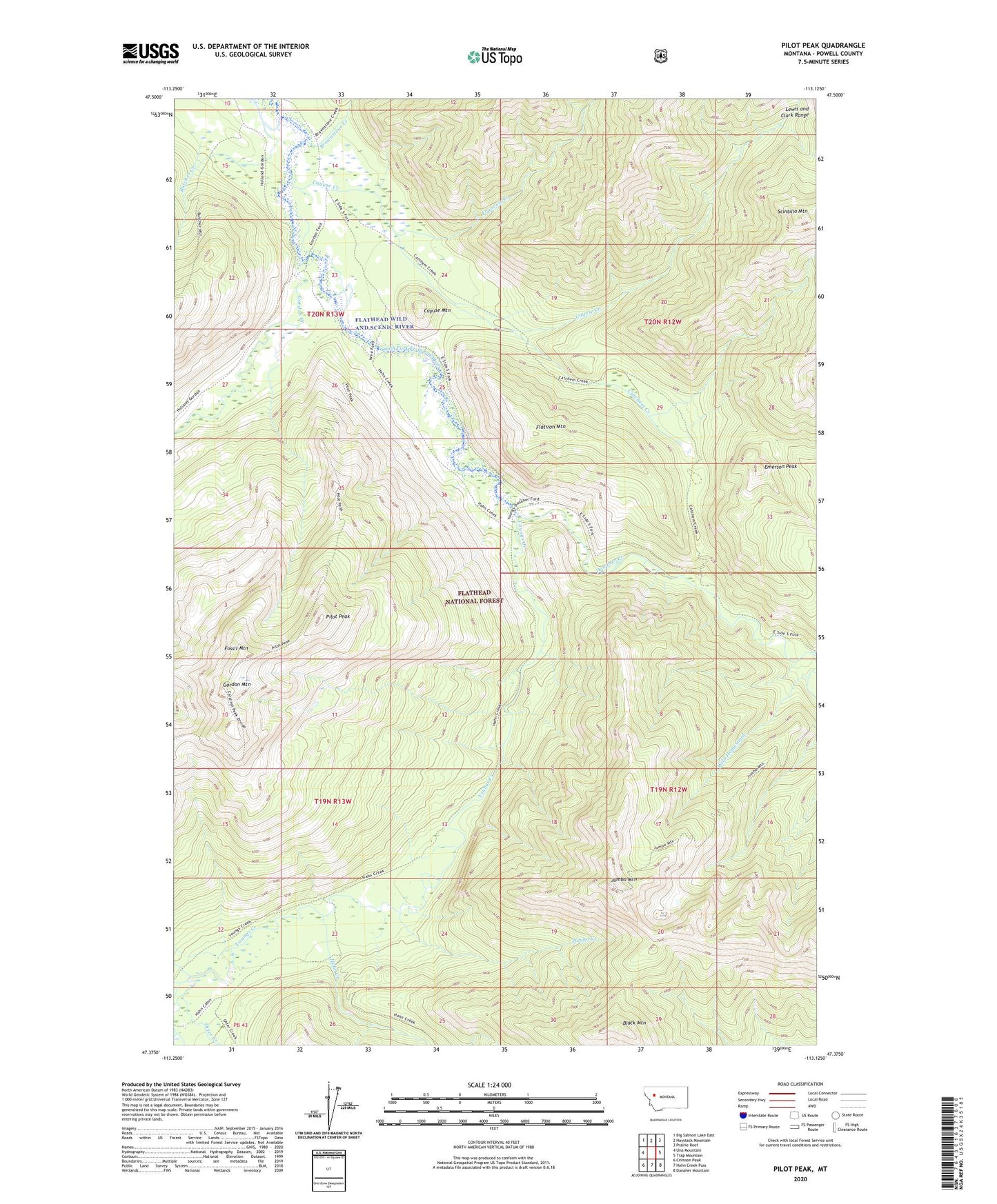
2020 topographic map quadrangle Pilot Peak in the state of Montana. Scale: 1:24000. Based on the newly updated USGS 7.5' US Topo map series, this map is in the following counties: Powell. The map contains contour data, water features, and other items you are used to seeing on USGS maps, but also has updated roads and other features. This is the next generation of topographic maps. Printed on high-quality waterproof paper with UV fade-resistant inks.
Quads adjacent to this one:
West: Una Mountain
Northwest: Big Salmon Lake East
North: Haystack Mountain
Northeast: Prairie Reef
East: Trap Mountain
Southeast: Danaher Mountain
South: Hahn Creek Pass
Southwest: Crimson Peak
Contains the following named places: Big Prairie, Black Mountain, Brownstone Creek, Butcher Creek, Cabin Creek, Catchem Creek, Catchem Creek Trail, Cayuse Creek, Cayuse Mountain, Danaher Creek, Emerson Peak, Flatiron Mountain, Fossil Mountain, Francois Creek, Gordon Creek, Gordon Mountain, Hahn Creek, Hahn Creek Guard Station, Jumbo Creek, Jumbo Lookout Trail, Jumbo Mountain, Kid Creek, Otter Creek, Pilot Peak, Scintilla Mountain, Wigwam Creek, Youngs Creek, Youngs Creek Ford