MyTopo
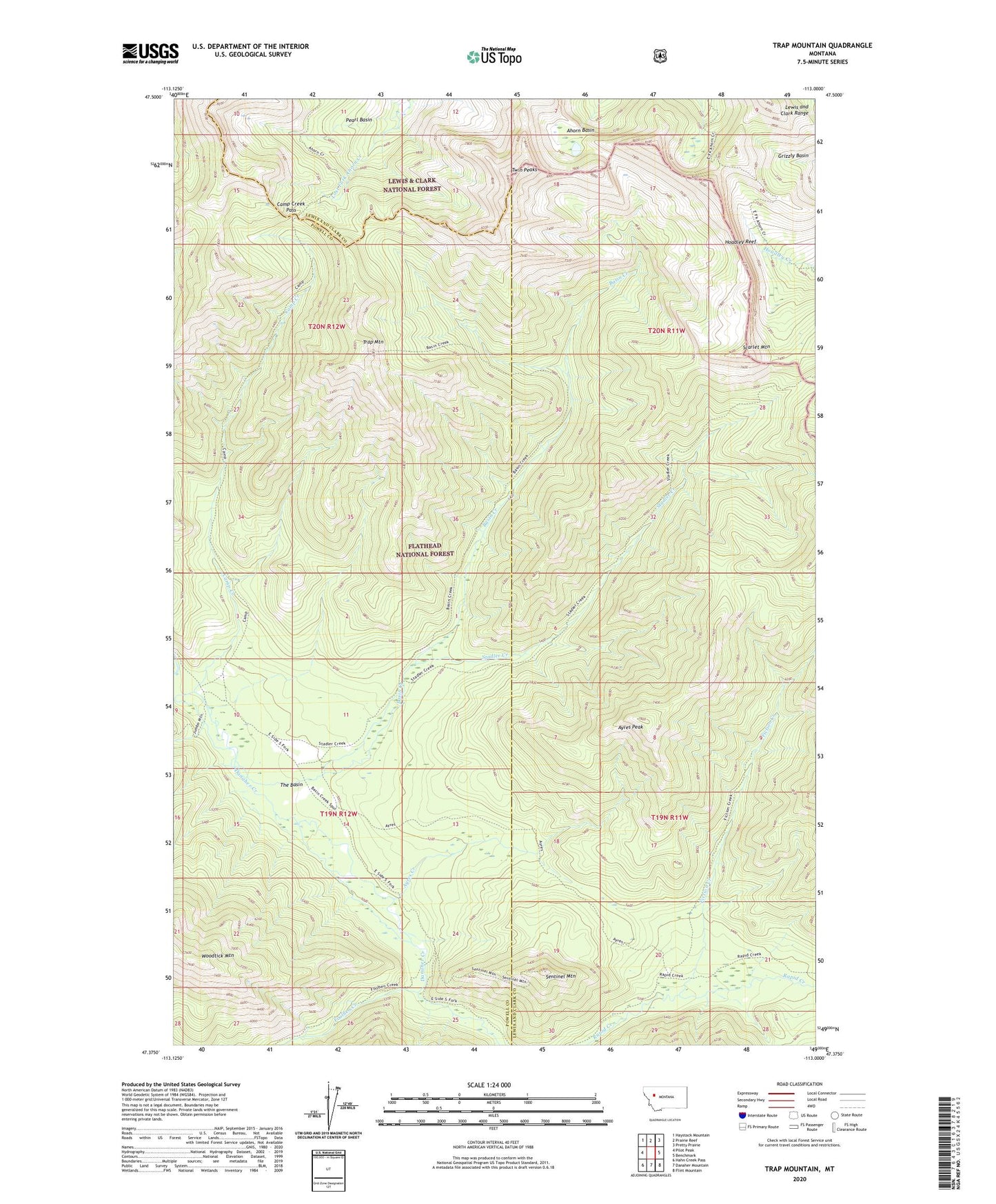
Trap Mountain Montana US Topo Map
Couldn't load pickup availability
Also explore the Trap Mountain Forest Service Topo of this same quad for updated USFS data
2024 topographic map quadrangle Trap Mountain in the state of Montana. Scale: 1:24000. Based on the newly updated USGS 7.5' US Topo map series, this map is in the following counties: Lewis and Clark, Powell. The map contains contour data, water features, and other items you are used to seeing on USGS maps, but also has updated roads and other features. This is the next generation of topographic maps. Printed on high-quality waterproof paper with UV fade-resistant inks.
Quads adjacent to this one:
West: Pilot Peak
Northwest: Haystack Mountain
North: Prairie Reef
Northeast: Pretty Prairie
East: Benchmark
Southeast: Flint Mountain
South: Danaher Mountain
Southwest: Hahn Creek Pass
This map covers the same area as the classic USGS quad with code o47113d1.
Contains the following named places: Ahorn Basin, Ahorn Creek Trail, Ayres Creek, Ayres Peak, Basin Creek, Basin Creek Guard Station, Camp Creek, Camp Creek Pass, Camp Creek Pass Trail, Fiction Creek, Foolhen Creek, Hoadley Reef, Pearl Basin, Scarlet Mountain, Sentinel Mountain, Stadler Creek, The Basin, Trap Mountain, Twin Peaks, Woodtick Mountain