MyTopo
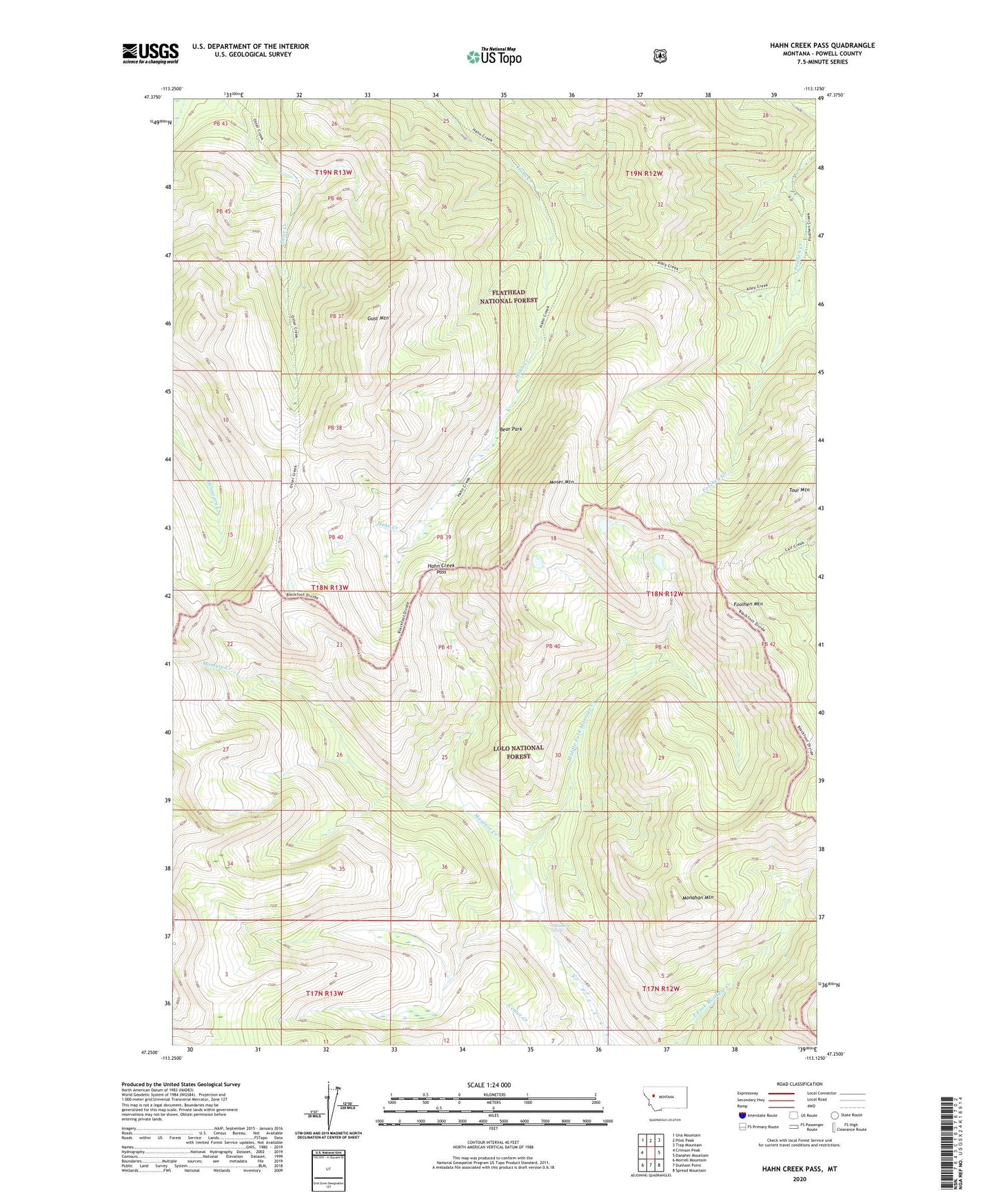
Hahn Creek Pass Montana US Topo Map
Couldn't load pickup availability
Also explore the Hahn Creek Pass Forest Service Topo of this same quad for updated USFS data
2024 topographic map quadrangle Hahn Creek Pass in the state of Montana. Scale: 1:24000. Based on the newly updated USGS 7.5' US Topo map series, this map is in the following counties: Powell. The map contains contour data, water features, and other items you are used to seeing on USGS maps, but also has updated roads and other features. This is the next generation of topographic maps. Printed on high-quality waterproof paper with UV fade-resistant inks.
Quads adjacent to this one:
West: Crimson Peak
Northwest: Una Mountain
North: Pilot Peak
Northeast: Trap Mountain
East: Danaher Mountain
Southeast: Spread Mountain
South: Dunham Point
Southwest: Morrell Mountain
This map covers the same area as the classic USGS quad with code o47113c2.
Contains the following named places: Bear Park, Center Creek, Center Creek Trail, Foolhen Creek Trail, Foolhen Mountain, Gust Mountain, Hahn Creek Pass, Limestone Pass Trail, Middle Fork Monture Creek, Monahan Mountain, Monture Falls, Monture Trail, Moser Mountain, Tour Mountain