MyTopo
Pinnacle Montana US Topo Map
Couldn't load pickup availability
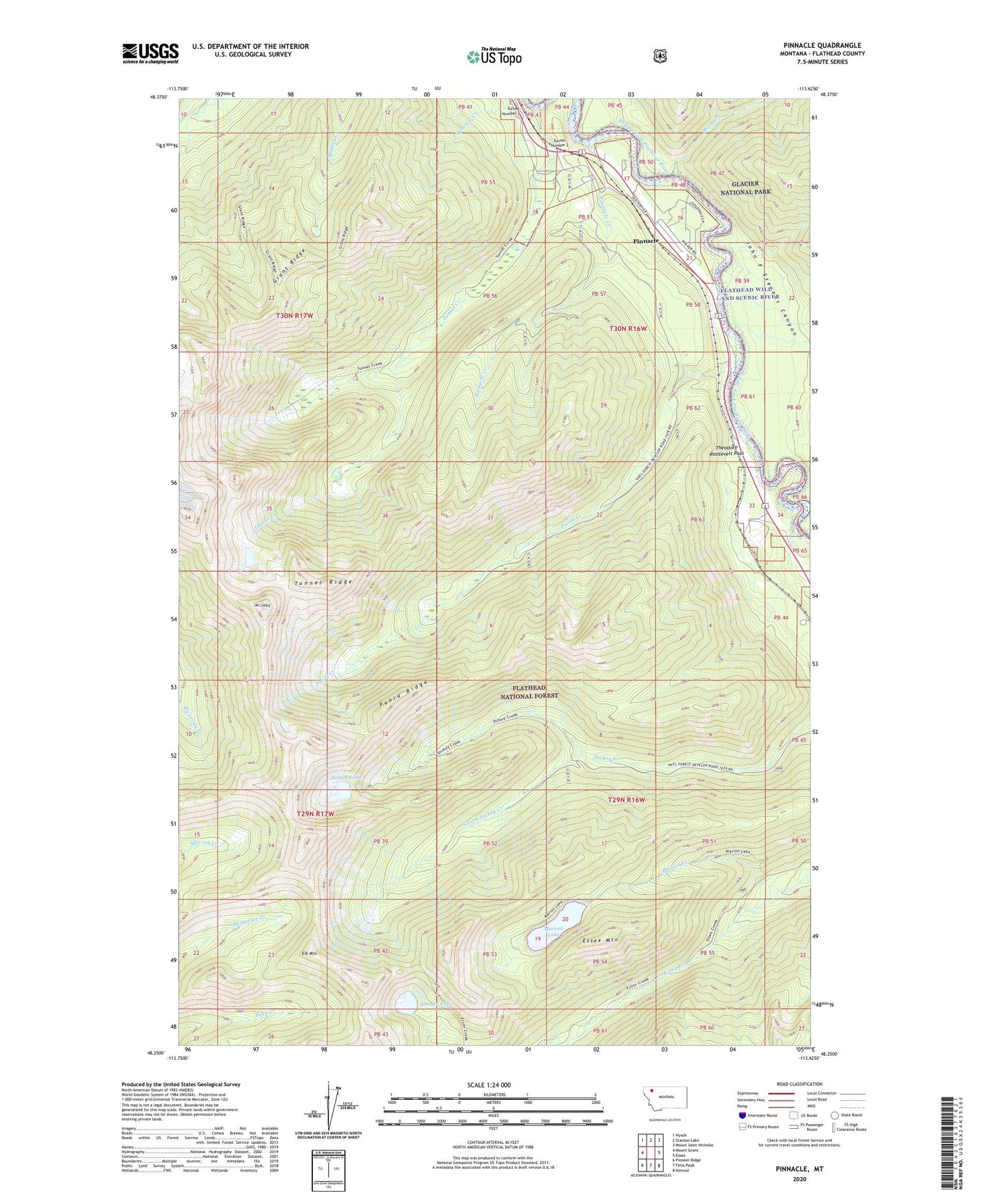
2020 topographic map quadrangle Pinnacle in the state of Montana. Scale: 1:24000. Based on the newly updated USGS 7.5' US Topo map series, this map is in the following counties: Flathead. The map contains contour data, water features, and other items you are used to seeing on USGS maps, but also has updated roads and other features. This is the next generation of topographic maps. Printed on high-quality waterproof paper with UV fade-resistant inks.
Quads adjacent to this one:
West: Mount Grant
Northwest: Nyack
North: Stanton Lake
Northeast: Mount Saint Nicholas
East: Essex
Southeast: Nimrod
South: Felix Peak
Southwest: Pioneer Ridge
Contains the following named places: Almeda Lake, Dickey Lake, Elk Mountain, Essex Mountain, Flathead Range, Grant Ridge Trail, Kuhns Fishing Access, Marion Creek, Marion Lake, Mount Liebig, Muir Creek, Paola, Paola Boat Launch, Paola Creek, Paola Post Office, Paola Ridge, Paola School, Pinnacle, Pinnacle Census Designated Place, Pinnacle Creek, South Fork Dickey Creek, Tunnel Creek, Tunnel Number 2, Tunnel Number 3, Tunnel Ridge