MyTopo
Quietus Montana US Topo Map
Couldn't load pickup availability
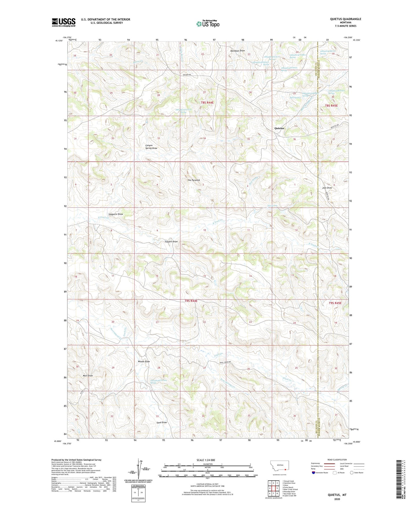
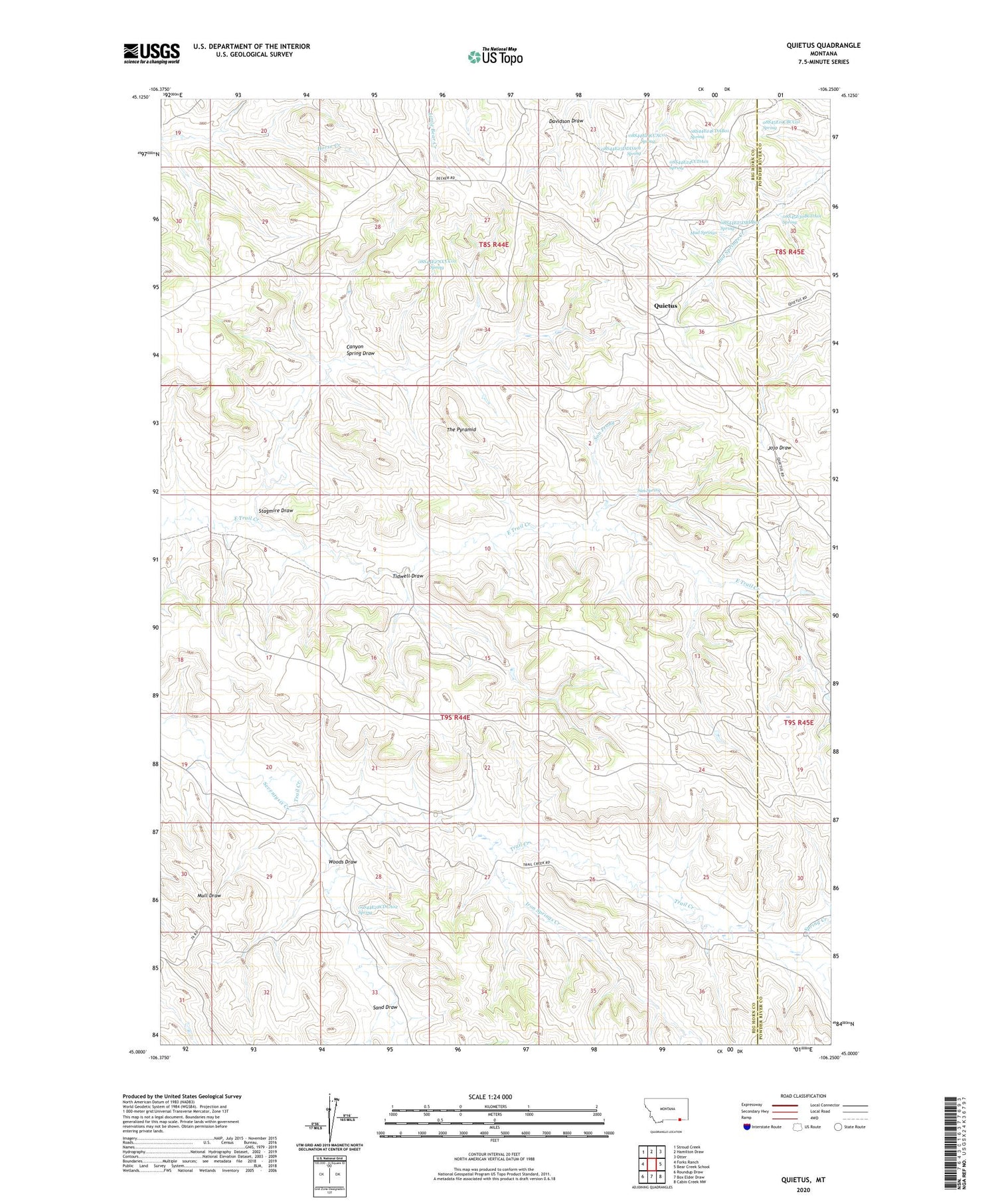
2020 topographic map quadrangle Quietus in the state of Montana. Scale: 1:24000. Based on the newly updated USGS 7.5' US Topo map series, this map is in the following counties: Big Horn, Powder River. The map contains contour data, water features, and other items you are used to seeing on USGS maps, but also has updated roads and other features. This is the next generation of topographic maps. Printed on high-quality waterproof paper with UV fade-resistant inks.
Quads adjacent to this one:
West: Forks Ranch
Northwest: Stroud Creek
North: Hamilton Draw
Northeast: Otter
East: Bear Creek School
Southeast: Cabin Creek NW
South: Box Elder Draw
Southwest: Roundup Draw
Contains the following named places: 08S44E20CBCC01 Well, 08S44E20CCBB01 Well, 08S44E22DCDB01 Well, 08S44E23DDDA01 Spring, 08S44E24CBCA01 Well, 08S44E24CCAC01 Spring, 08S44E24CCBC01 Well, 08S44E24CCDA01 Spring, 08S44E24CDAB01 Spring, 08S44E25DBDB01 Spring, 08S44E27CCCC01 Spring, 08S44E32DDAB01 Well, 08S44E35ADDC01 Well, 08S45E19CBCC01 Spring, 08S45E30BCDA01 Spring, 08S45E31BCCB01 Well, 09S44E01ADAA01 Well, 09S44E07AADD01 Well, 09S44E07ADAA01 Well, 09S44E07ADAB01 Well, 09S44E07ADAD01 Well, 09S44E07ADDC01 Well, 09S44E07ADDC02 Well, 09S44E07ADDC03 Well, 09S44E08BBAA01 Well, 09S44E08BBAA02 Well, 09S44E08BDDD01 Well, 09S44E09CBBD01 Well, 09S44E09CCAB01 Well, 09S44E10CBAD01 Well, 09S44E11BDAA01 Well, 09S44E16ABCC01 Well, 09S44E20DCAA01 Well, 09S44E27ABCB01 Well, 09S44E28CDCA02 Spring, 09S44E28CDCD01 Well, 09S44E33BADB01 Well, 09S45E07CCAD01 Well, Canyon Spring Draw, Cossit School, Iron Springs Creek, Mud Springs, Quietus, Quietus Post Office, San Spring, Sand Draw, Seventysix Creek, Son Prong, Spring Creek, Stagmire Draw, The Pyramid, Tidwell Draw, Woods Draw