
MyTopo
Rattlesnake Butte Montana US Topo Map
Couldn't load pickup availability
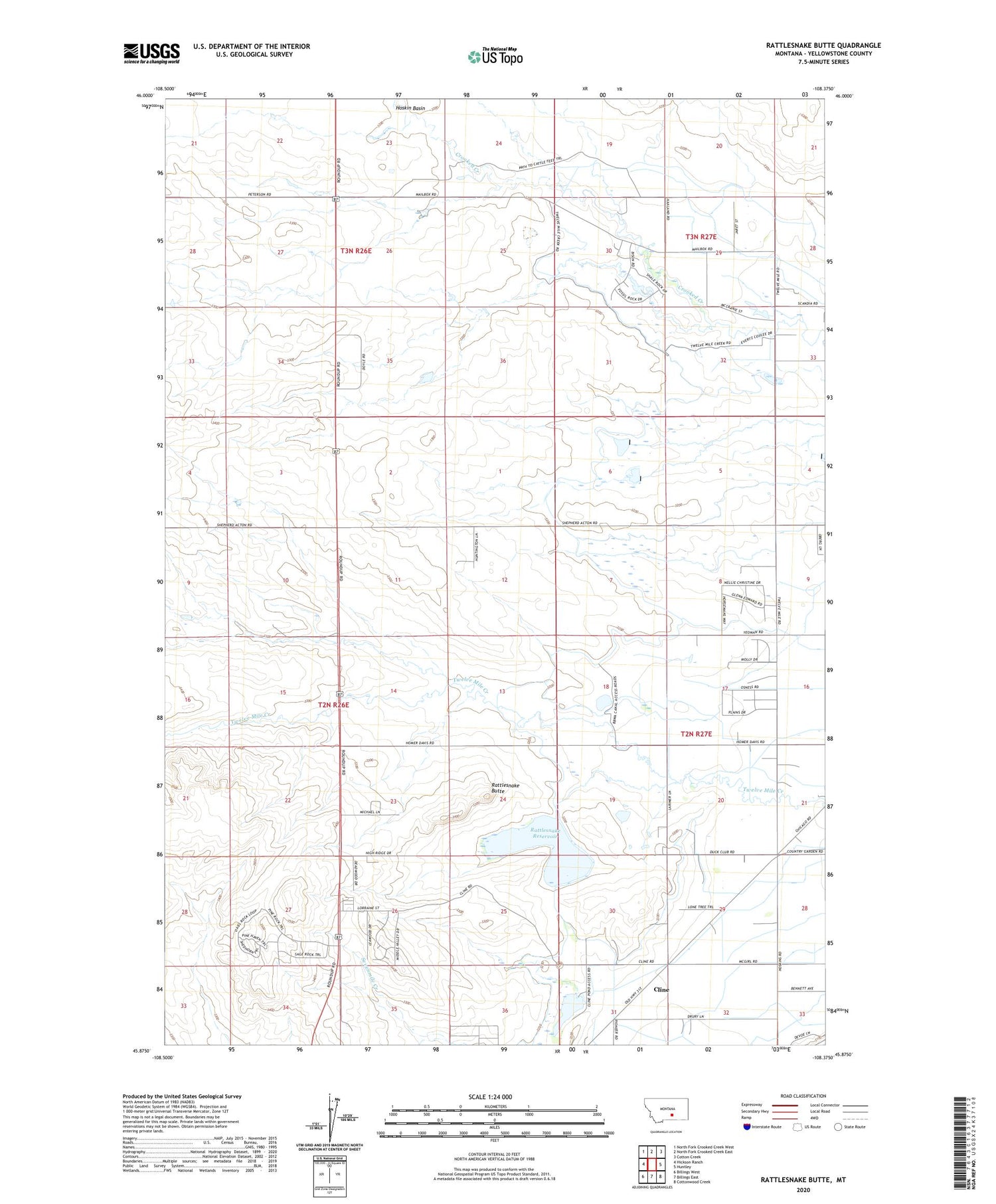
2020 topographic map quadrangle Rattlesnake Butte in the state of Montana. Scale: 1:24000. Based on the newly updated USGS 7.5' US Topo map series, this map is in the following counties: Yellowstone. The map contains contour data, water features, and other items you are used to seeing on USGS maps, but also has updated roads and other features. This is the next generation of topographic maps. Printed on high-quality waterproof paper with UV fade-resistant inks.
Quads adjacent to this one:
West: Hickson Ranch
Northwest: North Fork Crooked Creek West
North: North Fork Crooked Creek East
Northeast: Cotton Creek
East: Huntley
Southeast: Cottonwood Creek
South: Billings East
Southwest: Billings West
Contains the following named places: 02N26E22DDCB01 Well, 02N26E23C___01 Well, 02N26E26BCBC01 Well, 02N27E16CBBC01 Well, 02N27E20ABBC01 Well, 02N27E28BBBA01 Well, 02N27E30BCCB01 Well, 02N27E30DAAB01 Well, 02N27E31ABBC01 Well, 02N27E32AABB01 Well, 03N27E32ADAA01 Well, 59105, Charter Number 1 Dam, Cline, Crooked Creek Siphon, Progressive School, Rattlesnake Butte, Rattlesnake Reservoir, Rattlesnake Reservoir Dam, Retriever Number 1 Dam, Twelvemile Siphon


