MyTopo
Hickson Ranch Montana US Topo Map
Couldn't load pickup availability
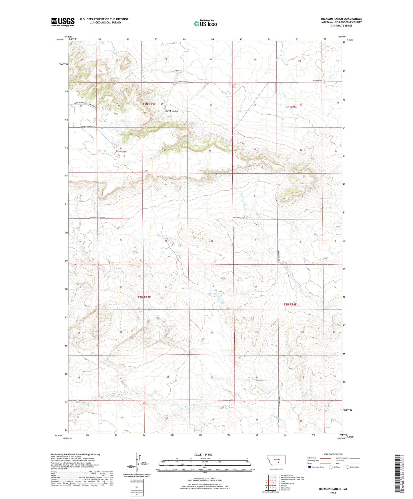
2024 topographic map quadrangle Hickson Ranch in the state of Montana. Scale: 1:24000. Based on the newly updated USGS 7.5' US Topo map series, this map is in the following counties: Yellowstone. The map contains contour data, water features, and other items you are used to seeing on USGS maps, but also has updated roads and other features. This is the next generation of topographic maps. Printed on high-quality waterproof paper with UV fade-resistant inks.
Quads adjacent to this one:
West: Acton
Northwest: Hay Basin South
North: North Fork Crooked Creek West
Northeast: North Fork Crooked Creek East
East: Rattlesnake Butte
Southeast: Billings East
South: Billings West
Southwest: Rimrock
This map covers the same area as the classic USGS quad with code o45108h5.
Contains the following named places: 02N25E22C___01 Well, 02N26E18D___01 Well, 02N26E21CDAD01 Well, Burnt Coulee, Dover D Dam Number 1, Hickson Ranch, Mackey Ranch, R Burton Number 1 Dam