MyTopo
Rattlesnake Ridge Montana US Topo Map
Couldn't load pickup availability
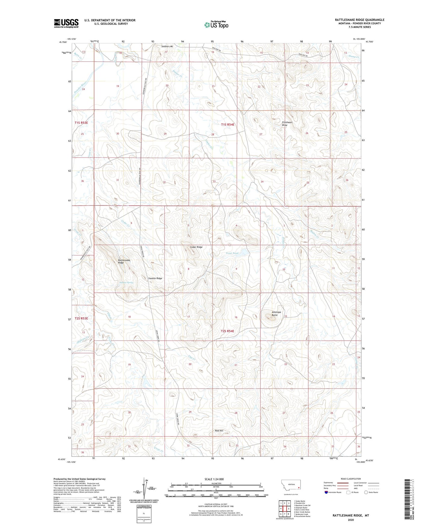
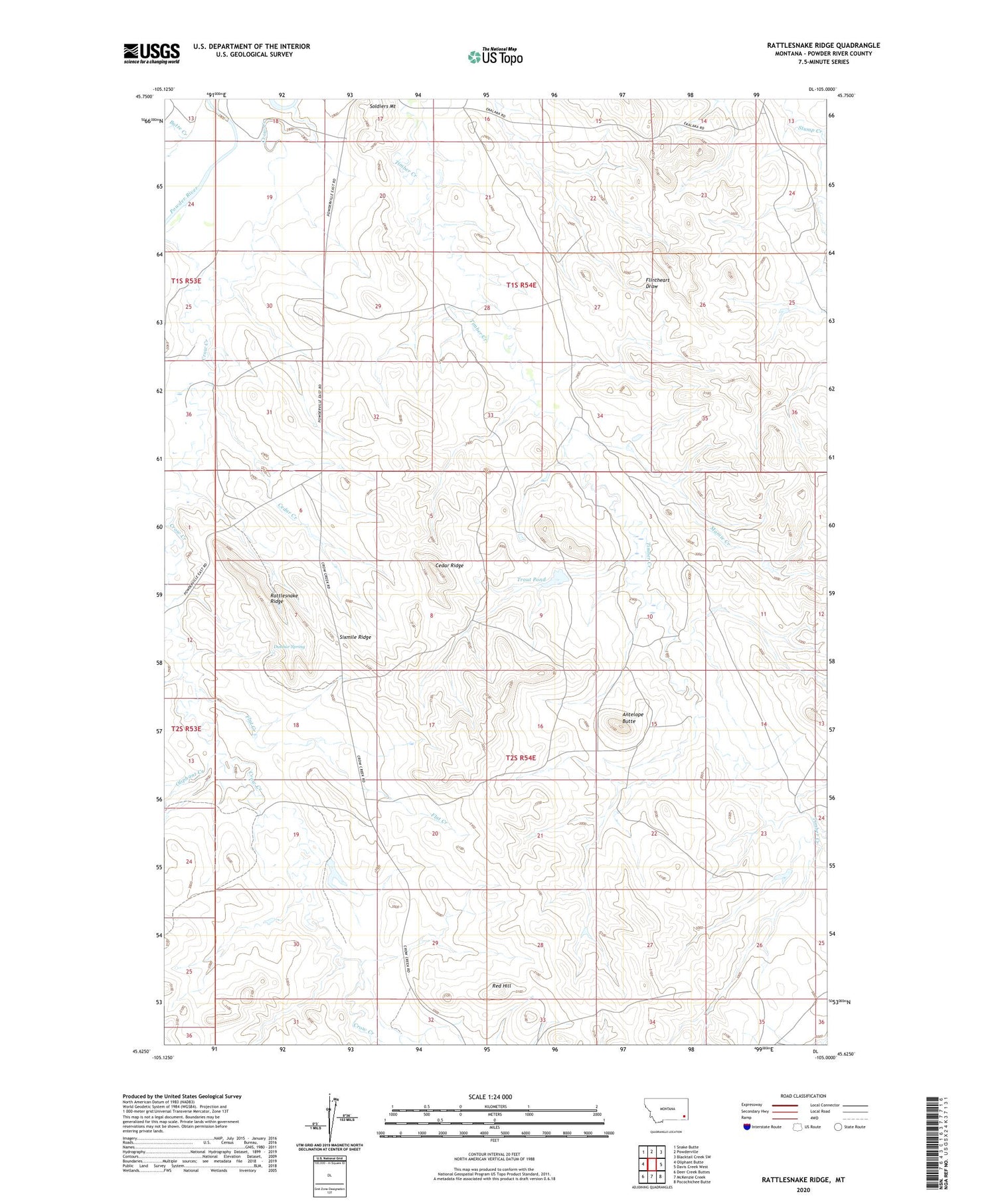
2020 topographic map quadrangle Rattlesnake Ridge in the state of Montana. Scale: 1:24000. Based on the newly updated USGS 7.5' US Topo map series, this map is in the following counties: Powder River. The map contains contour data, water features, and other items you are used to seeing on USGS maps, but also has updated roads and other features. This is the next generation of topographic maps. Printed on high-quality waterproof paper with UV fade-resistant inks.
Quads adjacent to this one:
West: Oliphant Butte
Northwest: Snake Butte
North: Powderville
Northeast: Blacktail Creek SW
East: Davis Creek West
Southeast: Pocochichee Butte
South: McKenzie Creek
Southwest: Deer Creek Buttes
Contains the following named places: 01S54E17CCAC01 Well, 01S54E18DDAC01 Well, 01S54E19BABA01 Well, 01S54E28ACCC01 Well, 01S54E35BDD_01 Well, 01S54E35BDDA01 Well, 02S53E12ACBA01 Well, 02S53E13ADDA01 Well, 02S53E25BDDD01 Well, 02S54E06DBB_01 Well, 02S54E19BDD_01 Well, 02S54E20BBD_01 Well, 02S54E23ADBA01 Well, Antelope Butte, Butte Creek, Cedar Creek, Cedar Ridge, Crow Creek, Dunbar Spring, Flat Creek, Mamie Creek, Oliphant Creek, Powderville School, Rattlesnake Ridge, Red Hill, Sixmile Ridge, Stump Dam, Trout Pond