MyTopo
Raymond Montana US Topo Map
Couldn't load pickup availability
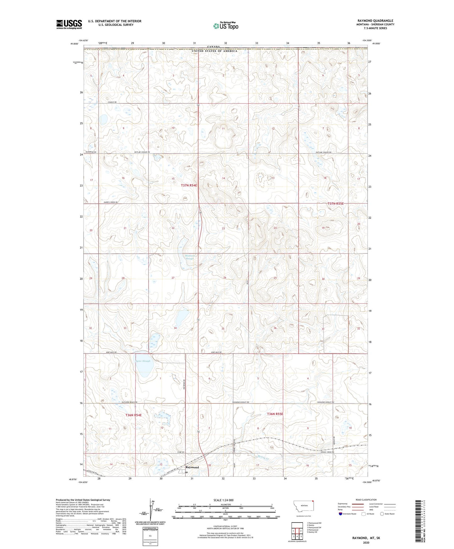
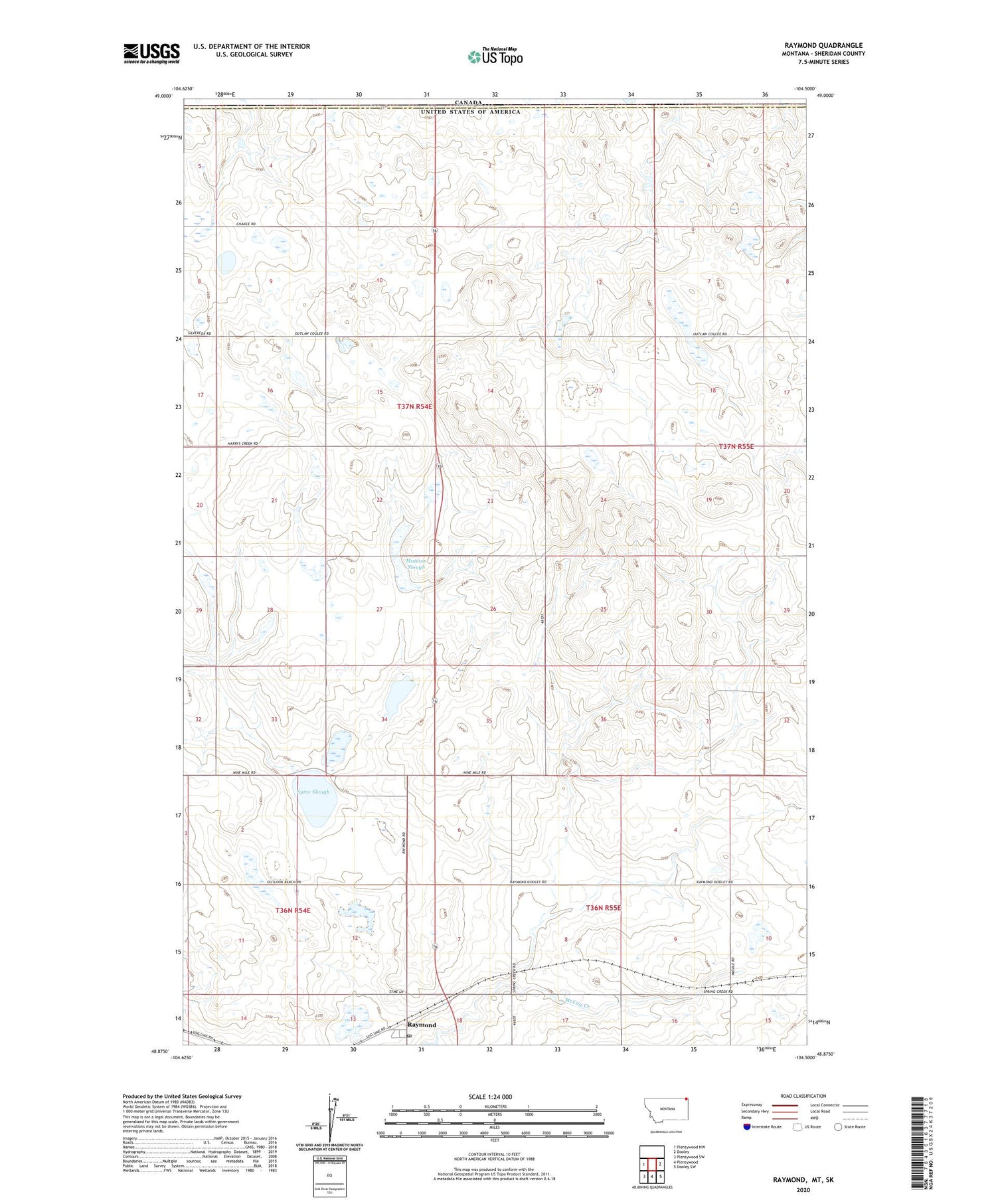
2020 topographic map quadrangle Raymond in the state of Montana. Scale: 1:24000. Based on the newly updated USGS 7.5' US Topo map series, this map is in the following counties: Sheridan. The map contains contour data, water features, and other items you are used to seeing on USGS maps, but also has updated roads and other features. This is the next generation of topographic maps. Printed on high-quality waterproof paper with UV fade-resistant inks.
Quads adjacent to this one:
West: Plentywood NW
East: Dooley
Southeast: Dooley SW
South: Plentywood
Southwest: Plentywood SW
Contains the following named places: 36N54E12DDDD01 Well, 59256, Corkery School, Gibson School, Hasland Number 2 Dam, Lochin Slough, Mattson Slough, Raymond, Raymond Community Hall, Raymond Lutheran Church, Raymond Post Office, Raymond School, Raymond Storage Dam, Saint Raymonds Church, Shermont Electric and Grain, Syme Slough, United States Customs and Border Protection Raymond Port of Entry