MyTopo
Dooley Montana US Topo Map
Couldn't load pickup availability
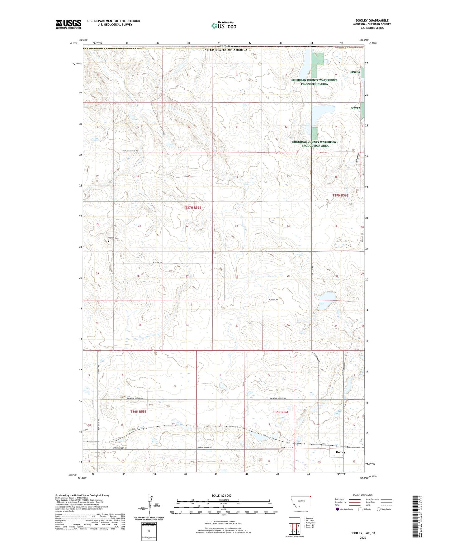
2024 topographic map quadrangle Dooley in the state of Montana. Scale: 1:24000. Based on the newly updated USGS 7.5' US Topo map series, this map is in the following counties: Sheridan. The map contains contour data, water features, and other items you are used to seeing on USGS maps, but also has updated roads and other features. This is the next generation of topographic maps. Printed on high-quality waterproof paper with UV fade-resistant inks.
Quads adjacent to this one:
West: Raymond
East: Park Lake
Southeast: Dooley SE
South: Dooley SW
Southwest: Plentywood
This map covers the same area as the classic USGS quad with code o48104h4.
Contains the following named places: 36N55E02CCAB01 Well, 36N56E16AABA01 Well, 37N55E28ADAB01 Well, Brightsmen Lake, Dooley, Dooley Grade School, Dooley High School, Dooley Post Office, Rocky Valley Lutheran Church, Wankel Cemetery, Wankel School