MyTopo
Robere Montana US Topo Map
Couldn't load pickup availability
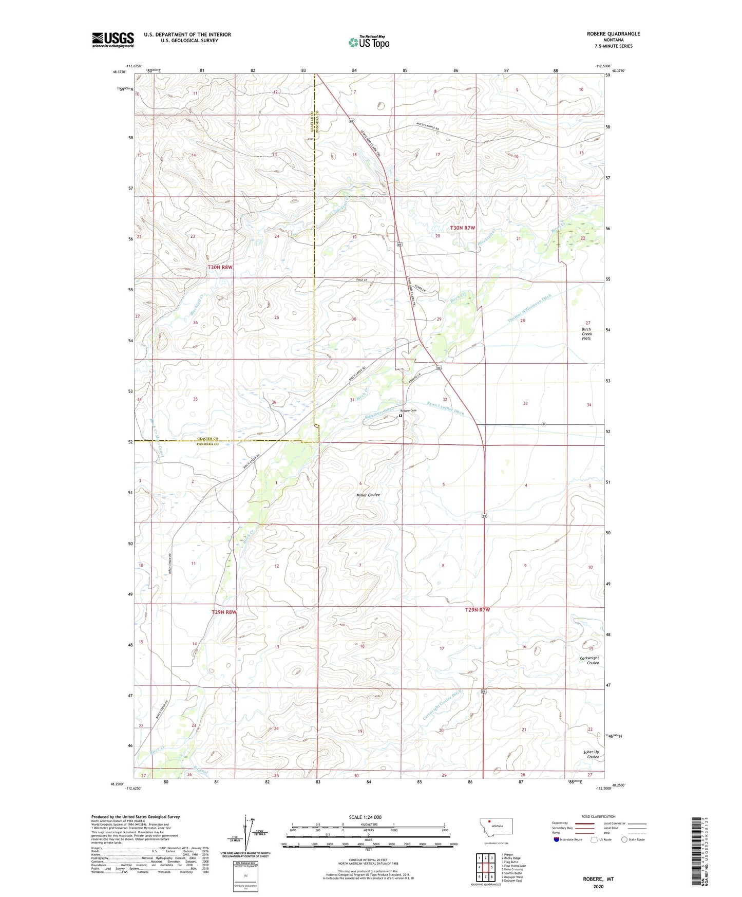
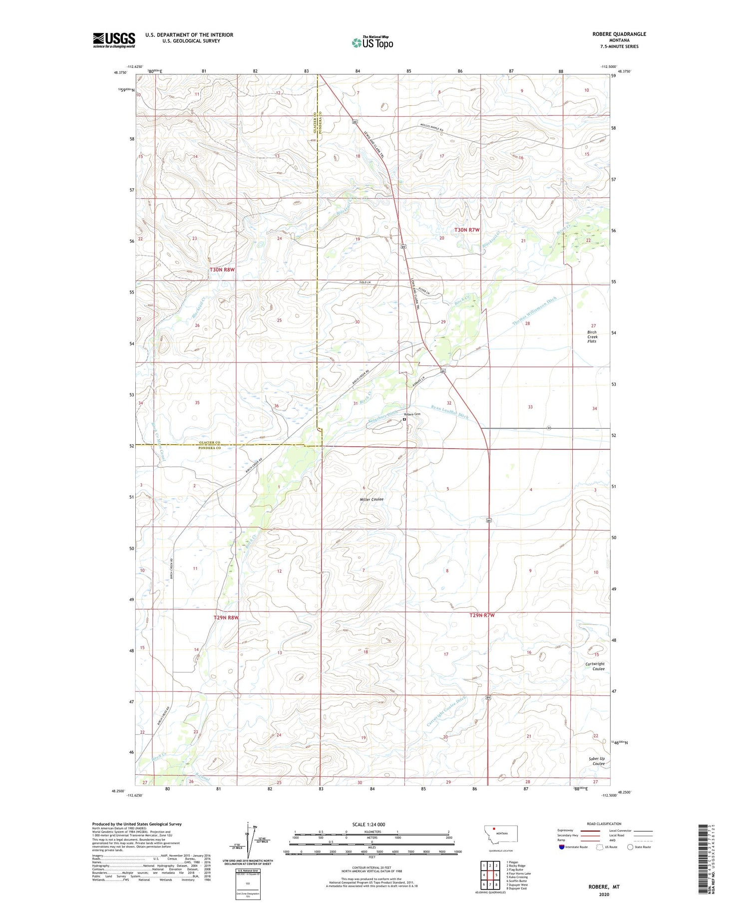
2020 topographic map quadrangle Robere in the state of Montana. Scale: 1:24000. Based on the newly updated USGS 7.5' US Topo map series, this map is in the following counties: Pondera, Glacier. The map contains contour data, water features, and other items you are used to seeing on USGS maps, but also has updated roads and other features. This is the next generation of topographic maps. Printed on high-quality waterproof paper with UV fade-resistant inks.
Quads adjacent to this one:
West: Four Horns Lake
Northwest: Piegan
North: Rocky Ridge
Northeast: Flag Butte
East: Kuka Crossing
Southeast: Dupuyer East
South: Dupuyer West
Southwest: Scoffin Butte
Contains the following named places: 30N07W29CDCB01 Well, Birch Creek Main Canal, Birch Creek Rodeo Ground, Blacktail Creek, Captain Meriwether Lewis Historical Marker, Cartwright Coulee Ditch, Grandview School, Kingsbury Ditch, Prando Chapel, Robare Cemetery, Robare Post Office, Robere, Ryan Lauffler Ditch, Thomas Williamson Ditch, Valier-Dupuyer Division