MyTopo
Four Horns Lake Montana US Topo Map
Couldn't load pickup availability
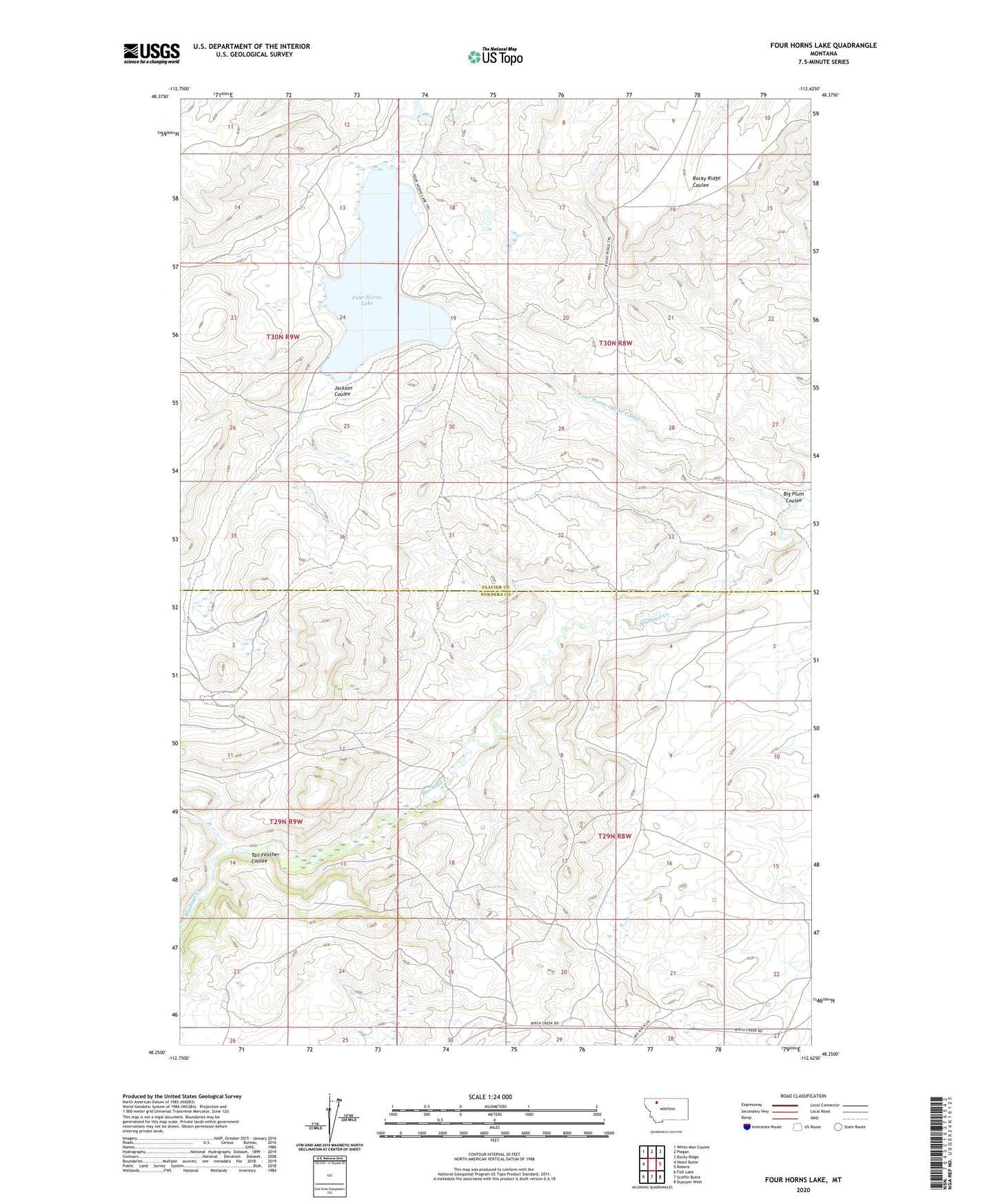
2024 topographic map quadrangle Four Horns Lake in the state of Montana. Scale: 1:24000. Based on the newly updated USGS 7.5' US Topo map series, this map is in the following counties: Glacier, Pondera. The map contains contour data, water features, and other items you are used to seeing on USGS maps, but also has updated roads and other features. This is the next generation of topographic maps. Printed on high-quality waterproof paper with UV fade-resistant inks.
Quads adjacent to this one:
West: Heart Butte
Northwest: White Man Coulee
North: Piegan
Northeast: Rocky Ridge
East: Robere
Southeast: Dupuyer West
South: Scoffin Butte
Southwest: Fish Lake
This map covers the same area as the classic USGS quad with code o48112c6.
Contains the following named places: Big Plum Coulee, Four Horns Dam, Four Horns Lake, Four Horns Outlet Canal, Jackson Coulee, Tail Feather Coulee