MyTopo
Kuka Crossing Montana US Topo Map
Couldn't load pickup availability
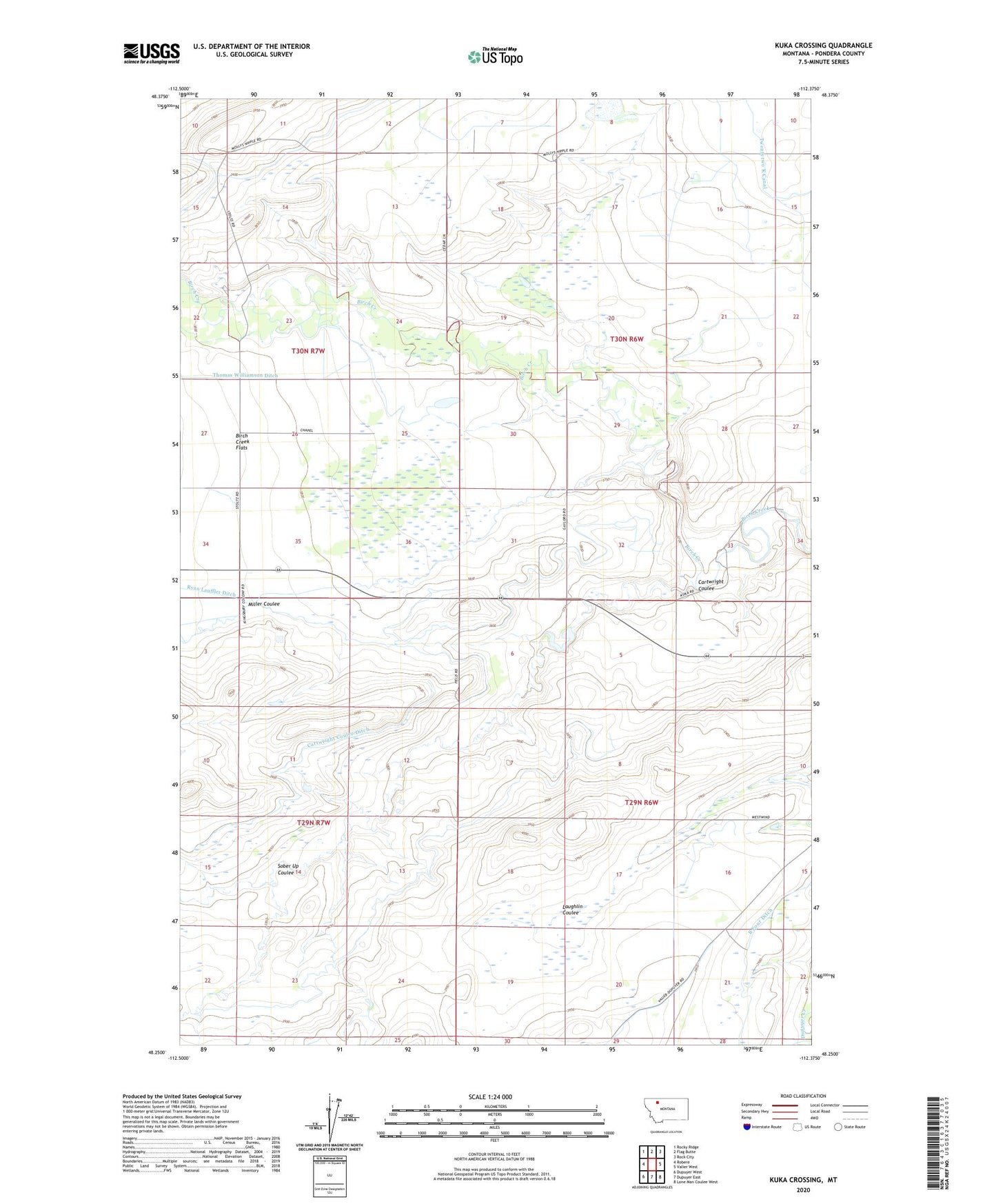
2024 topographic map quadrangle Kuka Crossing in the state of Montana. Scale: 1:24000. Based on the newly updated USGS 7.5' US Topo map series, this map is in the following counties: Pondera. The map contains contour data, water features, and other items you are used to seeing on USGS maps, but also has updated roads and other features. This is the next generation of topographic maps. Printed on high-quality waterproof paper with UV fade-resistant inks.
Quads adjacent to this one:
West: Robere
Northwest: Rocky Ridge
North: Flag Butte
Northeast: Rock City
East: Valier West
Southeast: Lone Man Coulee West
South: Dupuyer East
Southwest: Dupuyer West
This map covers the same area as the classic USGS quad with code o48112c4.
Contains the following named places: Aubrey Crossing, B Four Ditch, Bartley Ranch, Birch Creek Flats, Birch Creek School, Cartwright Coulee, Collins Ranch, Grand View School, Hubbard Ranch, Kingsbury Colony, Kingsbury Colony Census Designated Place, Kingsbury Colony School, Kuka Crossing, Kuka Ranch, Lauffer Ranch, Miller Coulee, Moser Ranch, Pierce Crossing, Pierce Ranch, Pondera Colony, Pondera Colony School, Ryan Ranch, Sober Up Coulee, Twentytwo K Canal, Wheeler Ranch, Wolstad Ranch, ZIP Code: 59486