MyTopo
Rock City Montana US Topo Map
Couldn't load pickup availability
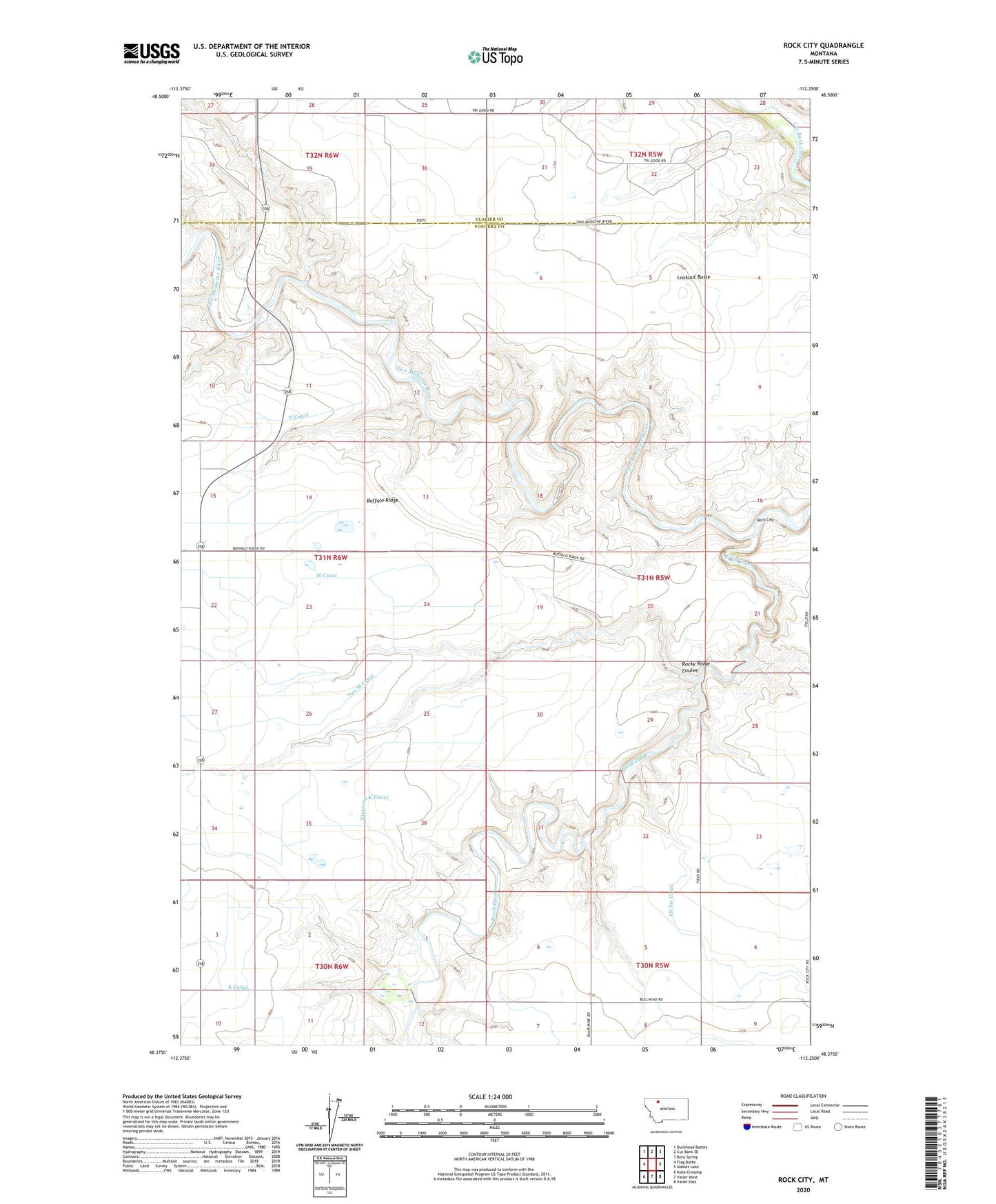
2020 topographic map quadrangle Rock City in the state of Montana. Scale: 1:24000. Based on the newly updated USGS 7.5' US Topo map series, this map is in the following counties: Pondera, Glacier. The map contains contour data, water features, and other items you are used to seeing on USGS maps, but also has updated roads and other features. This is the next generation of topographic maps. Printed on high-quality waterproof paper with UV fade-resistant inks.
Quads adjacent to this one:
West: Flag Butte
Northwest: Duckhead Buttes
North: Cut Bank SE
Northeast: Boru Spring
East: Abbott Lake
Southeast: Valier East
South: Valier West
Southwest: Kuka Crossing
Contains the following named places: 31N05W34CCCC01 Well, AN Six Canal, Birch Creek, Blair Crossing, Blair Mine, Buffalo Ridge, K Canal, Kennedy Mine, Kingston Mine, Lenoir Ranch, Lookout Butte, Nineteen K Canal, Pioneer Farm, Rock City, Rocky Ridge Coulee, Shields Crossing, Slezak Mine, Two M Canal, Uleberg School