MyTopo
Sand Springs Montana US Topo Map
Couldn't load pickup availability
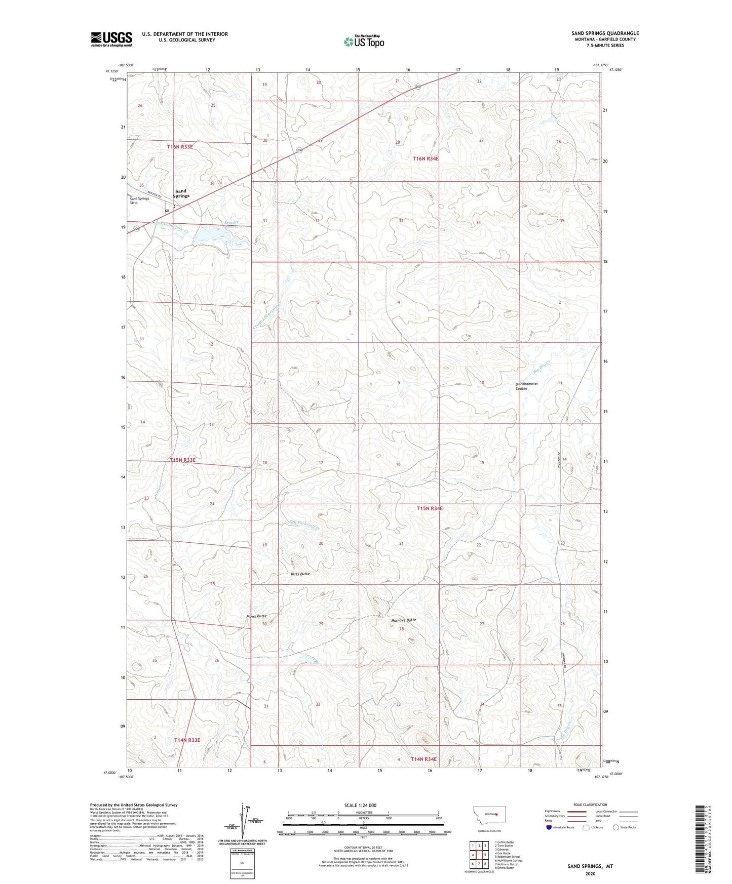
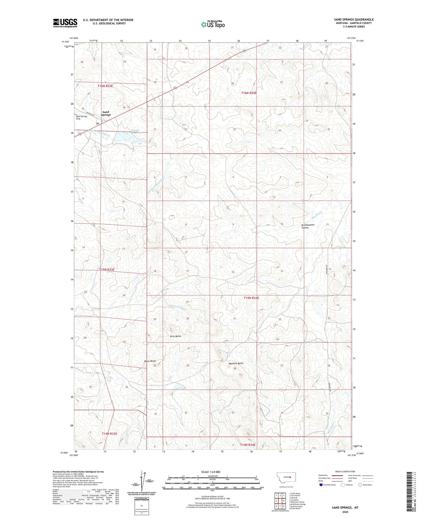
2020 topographic map quadrangle Sand Springs in the state of Montana. Scale: 1:24000. Based on the newly updated USGS 7.5' US Topo map series, this map is in the following counties: Garfield. The map contains contour data, water features, and other items you are used to seeing on USGS maps, but also has updated roads and other features. This is the next generation of topographic maps. Printed on high-quality waterproof paper with UV fade-resistant inks.
Quads adjacent to this one:
West: Cox Butte
Northwest: Coffin Butte
North: Twin Buttes
Northeast: Edwards
East: Robertson School
Southeast: Emma Butte
South: McGinnis Butte
Southwest: McWilliams Springs
Contains the following named places: 15N33E13ADDA01 Well, 15N34E16DADA01 Well, 71 Ranch Number 3 Dam, Blue Shoes Dam, Brickhammer Coulee, Charagus Dam, Kirts Butte, Krieder Reservoir, Manlove Butte, Mows Butte, Sand Springs, Sand Springs Post Office, Sand Springs School, Snowbelt Post Office, Snowbelt Reservoir Dam, Snowbelt School