
MyTopo
Sayle Montana US Topo Map
Couldn't load pickup availability
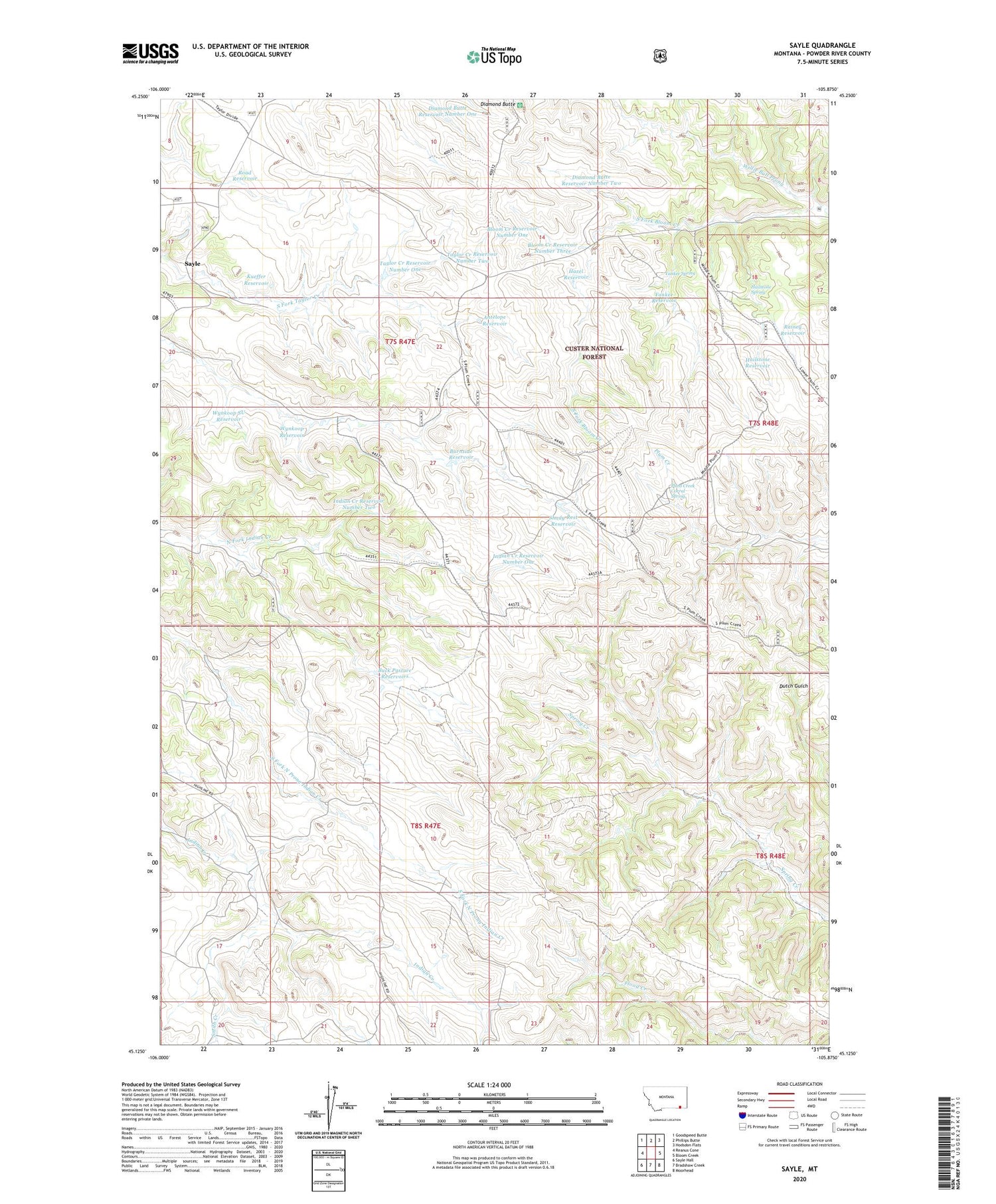
2020 topographic map quadrangle Sayle in the state of Montana. Scale: 1:24000. Based on the newly updated USGS 7.5' US Topo map series, this map is in the following counties: Powder River. The map contains contour data, water features, and other items you are used to seeing on USGS maps, but also has updated roads and other features. This is the next generation of topographic maps. Printed on high-quality waterproof paper with UV fade-resistant inks.
Quads adjacent to this one:
West: Reanus Cone
Northwest: Goodspeed Butte
North: Phillips Butte
Northeast: Hodsdon Flats
East: Bloom Creek
Southeast: Moorhead
South: Bradshaw Creek
Southwest: Sayle Hall
Contains the following named places: 07S47E21BABC01 Well, 07S47E27DBBA01 Well, 08S47E08DABC01 Well, 08S47E08DABC02 Well, 08S47E08DB__01 Well, 08S47E16BBCC01 Well, 08S48E17BBCB01 Well, Antelope Reservoir, Antelope Well, Bloom Creek Reservoir Number One, Bloom Creek Reservoir Number Three, Bloom Creek Reservoir Number Two, Buck Pasture Reservoirs, Burnside Reservoir, Burnside Well, Diamond Butte, Diamond Butte Reservoir Number One, Diamond Butte Reservoir Number Two, Hailstone Reservoir, Hailstone Spring, Hazel Reservoir, Indian Creek Reservoir Number One, Indian Creek Reservoir Number Two, Kueffer Reservoir, Plum Creek Corral Spring, Rainey Reservoir, Road Reservoir, Sayle, Shady Rest Reservoir, Smith Creek, Taylor Creek Reservoir Number One, Taylor Creek Reservoir Number Two, Willie Bull Prong, Wynkoop Reservoir, Wynkoop SU Reservoir, Yankee Reservoir, Yankee Spring


