MyTopo
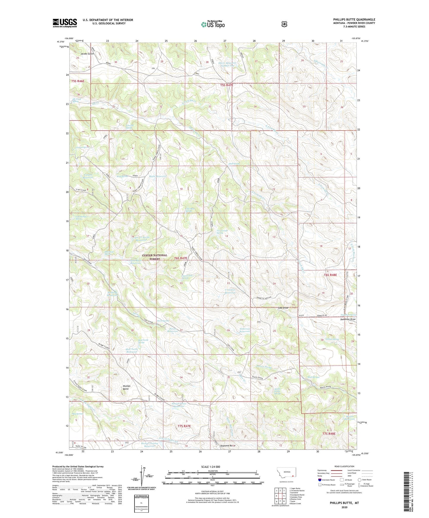
Phillips Butte Montana US Topo Map
Couldn't load pickup availability
Also explore the Phillips Butte Forest Service Topo of this same quad for updated USFS data
2024 topographic map quadrangle Phillips Butte in the state of Montana. Scale: 1:24000. Based on the newly updated USGS 7.5' US Topo map series, this map is in the following counties: Powder River. The map contains contour data, water features, and other items you are used to seeing on USGS maps, but also has updated roads and other features. This is the next generation of topographic maps. Printed on high-quality waterproof paper with UV fade-resistant inks.
Quads adjacent to this one:
West: Goodspeed Butte
Northwest: Yager Butte
North: Threemile Buttes
Northeast: Sonnette
East: Hodsdon Flats
Southeast: Bloom Creek
South: Sayle
Southwest: Reanus Cone
This map covers the same area as the classic USGS quad with code o45105c8.
Contains the following named places: Anderson Reservoir, Basin Reservoir, Canyon Reservoir, Canyon Spring, Coal Hollow Spring, Coal Mine Spring, Crowfoot Reservoir, Deadman Spring, Elk Creek Reservoir Number One, Elk Creek Spring, Halfway Reservoir, Lyon Creek Divide Reservoir, Lyon Creek Spring, Mason Prong Spring, Mason Reservoir, May Springs, Mud Turtle Reservoir, Mud Turtle Spring, North Fork Elk Creek, North Fork Taylor Creek Well, Phillips Butte, Pierce Reservoir, Pierce Spring, Red Shale Spring, Rock Spring, Rocky Crossing Reservoir, Sand Rock Reservoir, Schwind Spring, Skull Springs, Slough Grass Reservoir, Snell Spring, South Fork Elk Creek, Two Trough Spring, Willow Spring