
MyTopo
Schultz Saddle Montana US Topo Map
Couldn't load pickup availability
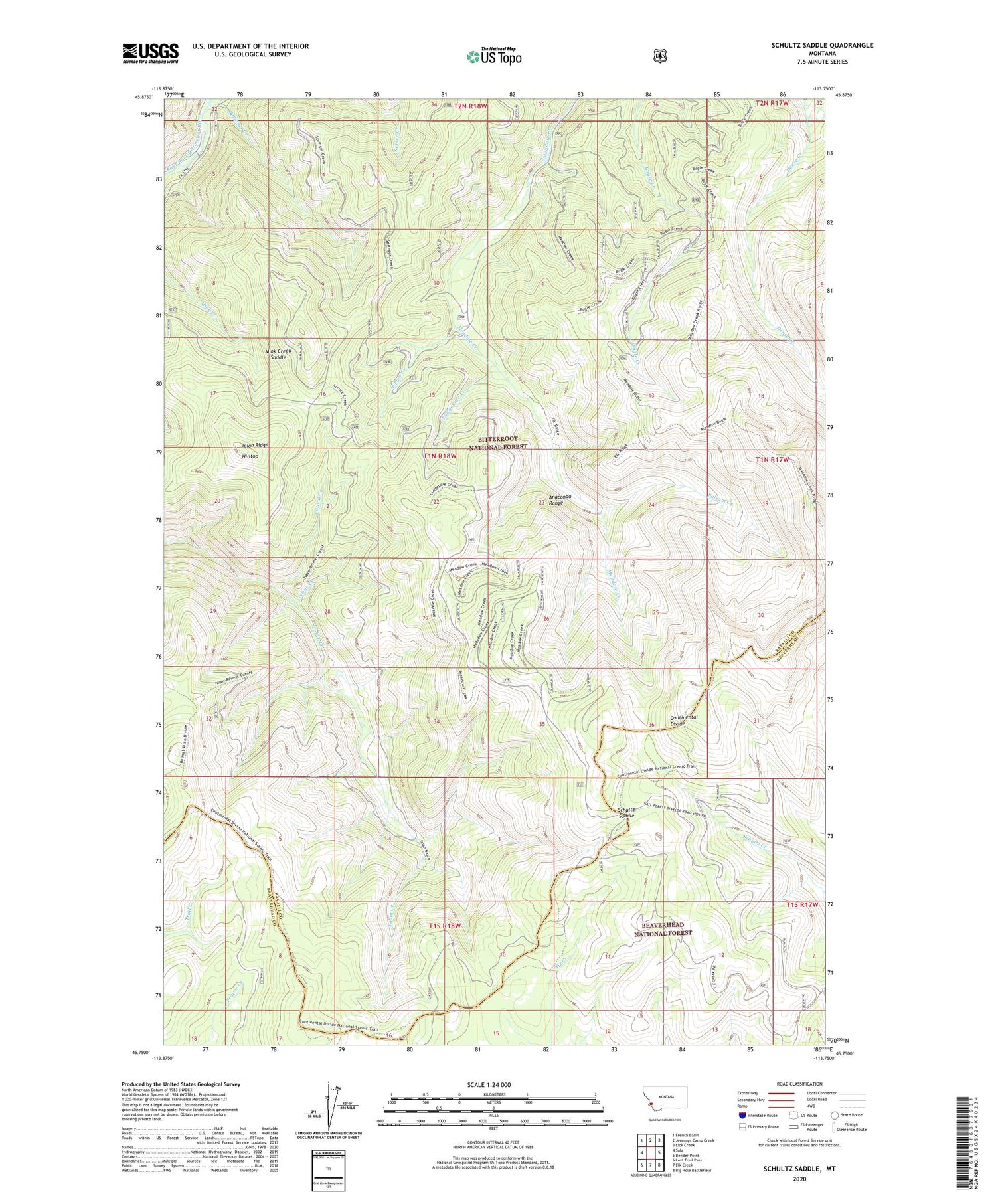
2020 topographic map quadrangle Schultz Saddle in the state of Montana. Scale: 1:24000. Based on the newly updated USGS 7.5' US Topo map series, this map is in the following counties: Ravalli, Beaverhead. The map contains contour data, water features, and other items you are used to seeing on USGS maps, but also has updated roads and other features. This is the next generation of topographic maps. Printed on high-quality waterproof paper with UV fade-resistant inks.
Quads adjacent to this one:
West: Sula
Northwest: French Basin
North: Jennings Camp Creek
Northeast: Lick Creek
East: Bender Point
Southeast: Big Hole Battlefield
South: Elk Creek
Southwest: Lost Trail Pass
Contains the following named places: Balsam Creek, Dense Creek, Four B Creek, Hilltop, Lodgepole Creek, Mink Creek Saddle, Schultz Saddle, Springer Creek, Spruce Creek, Stone Creek, Tolan Ridge, ZIP Code: 59871


