MyTopo
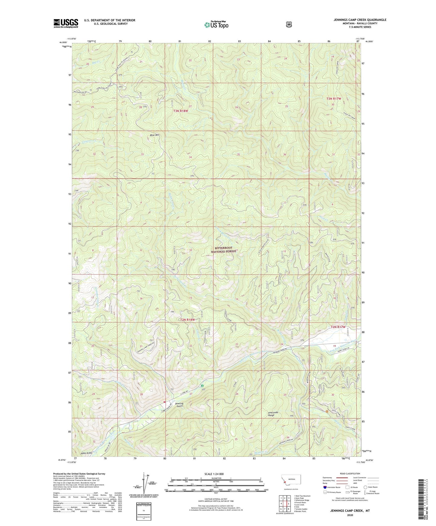
Jennings Camp Creek Montana US Topo Map
Couldn't load pickup availability
Also explore the Jennings Camp Creek Forest Service Topo of this same quad for updated USFS data
2024 topographic map quadrangle Jennings Camp Creek in the state of Montana. Scale: 1:24000. Based on the newly updated USGS 7.5' US Topo map series, this map is in the following counties: Ravalli. The map contains contour data, water features, and other items you are used to seeing on USGS maps, but also has updated roads and other features. This is the next generation of topographic maps. Printed on high-quality waterproof paper with UV fade-resistant inks.
Quads adjacent to this one:
West: French Basin
Northwest: Bald Top Mountain
North: Kent Peak
Northeast: Whetstone Ridge
East: Lick Creek
Southeast: Bender Point
South: Schultz Saddle
Southwest: Sula
This map covers the same area as the classic USGS quad with code o45113h7.
Contains the following named places: Bertie Lord Creek, Blue Mountain, Bugle Creek, Colvert Creek, Dowling Gulch, East Fork Bertie Creek, Guide Creek, Jakes Draw, Jennings Camp Creek, Jennings Campground, Kerlee Creek, Meadow Creek, Sula Rural Fire District Station 4, Swift Creek, Tepee Creek