MyTopo
Shannon Bridge Montana US Topo Map
Couldn't load pickup availability
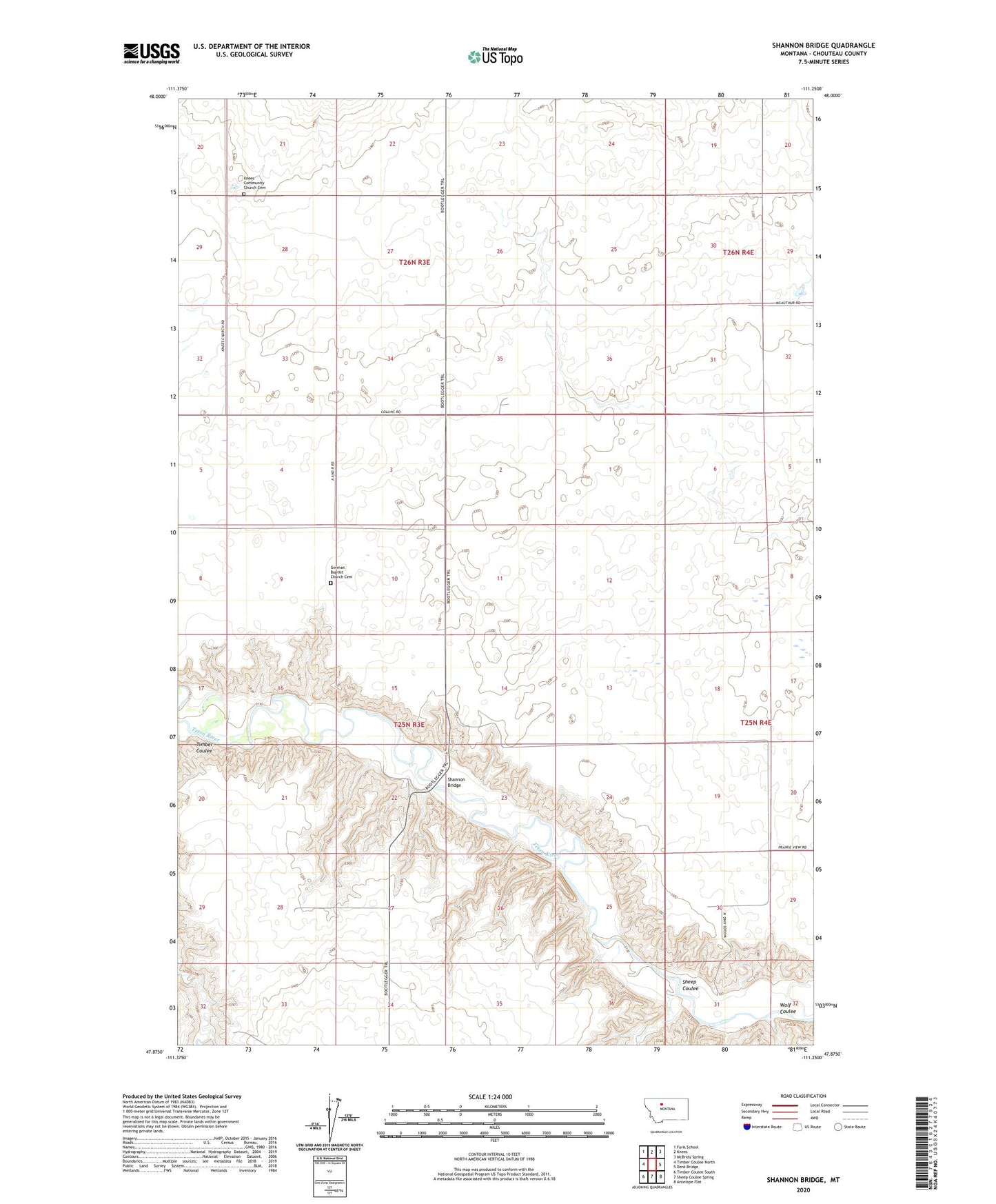
2024 topographic map quadrangle Shannon Bridge in the state of Montana. Scale: 1:24000. Based on the newly updated USGS 7.5' US Topo map series, this map is in the following counties: Chouteau. The map contains contour data, water features, and other items you are used to seeing on USGS maps, but also has updated roads and other features. This is the next generation of topographic maps. Printed on high-quality waterproof paper with UV fade-resistant inks.
Quads adjacent to this one:
West: Timber Coulee North
Northwest: Faris School
North: Knees
Northeast: McBridy Spring
East: Dent Bridge
Southeast: Antelope Flat
South: Sheep Coulee Spring
Southwest: Timber Coulee South
This map covers the same area as the classic USGS quad with code o47111h3.
Contains the following named places: Aznoe, Aznoe Post Office, Aznoe School, German Baptist Church, German Baptist Church Cemetery, Knee Church, Knees Community Church Cemetery, Knees Volunteer Fire Company, Shannon Bridge, Sheep Coulee, Timber Coulee, Wolf Coulee, Woods Crossing