MyTopo
Snake Creek School Montana US Topo Map
Couldn't load pickup availability
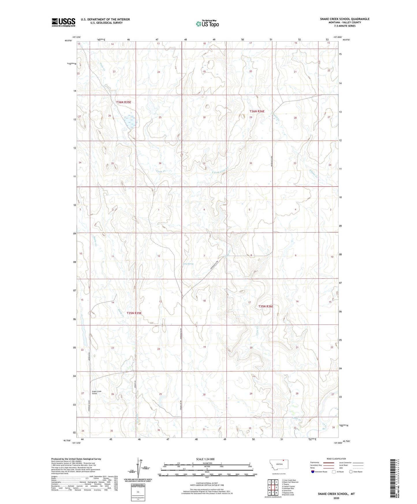
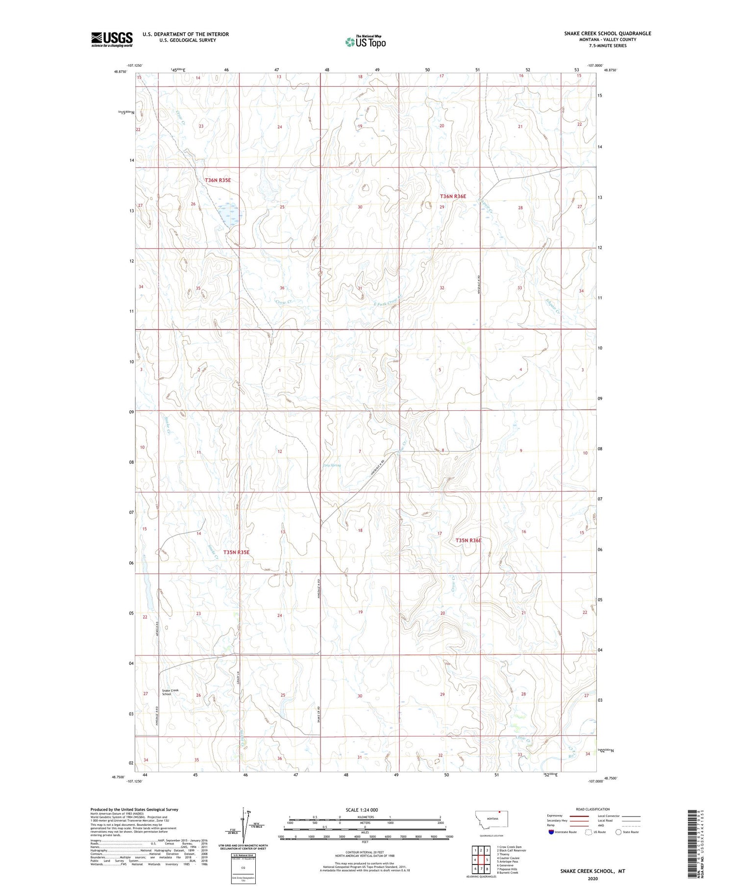
2020 topographic map quadrangle Snake Creek School in the state of Montana. Scale: 1:24000. Based on the newly updated USGS 7.5' US Topo map series, this map is in the following counties: Valley. The map contains contour data, water features, and other items you are used to seeing on USGS maps, but also has updated roads and other features. This is the next generation of topographic maps. Printed on high-quality waterproof paper with UV fade-resistant inks.
Quads adjacent to this one:
West: Coulter Coulee
Northwest: Crow Creek Dam
North: Black Calf Reservoir
Northeast: Thoeny
East: Antelope Pass
Southeast: Burnett Creek
South: Papoose Hills
Southwest: Genevieve
Contains the following named places: 34N36E19BD__01 Well, Duncan School, Dyncan Number 2 Dam, East Fork Crow Creek, Frank Jenson Number 1 Dam, Snake Creek School, Tiny Spring