MyTopo
Genevieve Montana US Topo Map
Couldn't load pickup availability
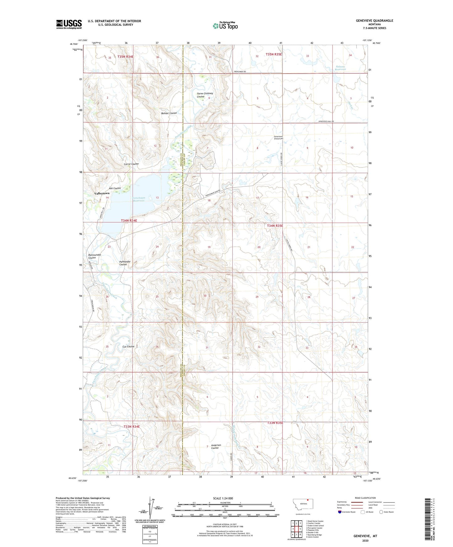
2024 topographic map quadrangle Genevieve in the state of Montana. Scale: 1:24000. Based on the newly updated USGS 7.5' US Topo map series, this map is in the following counties: Valley, Phillips. The map contains contour data, water features, and other items you are used to seeing on USGS maps, but also has updated roads and other features. This is the next generation of topographic maps. Printed on high-quality waterproof paper with UV fade-resistant inks.
Quads adjacent to this one:
West: Porcupine Coulee
Northwest: Dead Horse Coulee
North: Coulter Coulee
Northeast: Snake Creek School
East: Papoose Hills
Southeast: Jones Coulee
South: Bjornberg Bridge
Southwest: Double S Hill
This map covers the same area as the classic USGS quad with code o48107f2.
Contains the following named places: 35N35E32CD__01 Well, 35N35E32CDD_01 Well, Ash Coulee, Bohner Coulee, Corral Coulee, Cut Coulee, Frenchman Dam, Frenchman Reservoir, Genevieve, Genevieve Post Office, Genevieve School, Hatton School, Janeauxs Post, Nelsons Reservoir, Panhandle Coulee, Rattlesnake Coulee, Three Chimney Coulee, Valleytown, Valleytown Post Office, VR-72 Dam, Wright School