MyTopo
Snider Hill Montana US Topo Map
Couldn't load pickup availability
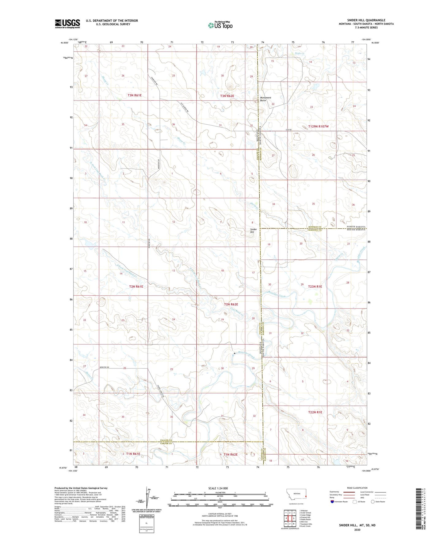
2024 topographic map quadrangle Snider Hill in the state of Montana. Scale: 1:24000. Based on the newly updated USGS 7.5' US Topo map series, this map is in the following counties: Fallon, Harding, Bowman, Carter. The map contains contour data, water features, and other items you are used to seeing on USGS maps, but also has updated roads and other features. This is the next generation of topographic maps. Printed on high-quality waterproof paper with UV fade-resistant inks.
Quads adjacent to this one:
West: Flasted Hill
Northwest: Webster
North: Scole School
Northeast: Cedar Ridge
Southeast: Scott Creek
South: Humbolt Hills
Southwest: Mill Iron
Contains the following named places: 01N61E01ABBD01 Well, 02N61E23DABA01 Well, 02N61E36DADC01 Well, 14N60E14CCCC01 Well, Coal Bank Creek, Horse Creek, Knobs, Knobs Post Office, Meccage Number 3 Dam, Monument Butte, North Fork Coal Bank Creek, Sheep Creek, Snider Hill, South Fork Coal Bank Creek, Squabble Creek