MyTopo
Sula Montana US Topo Map
Couldn't load pickup availability
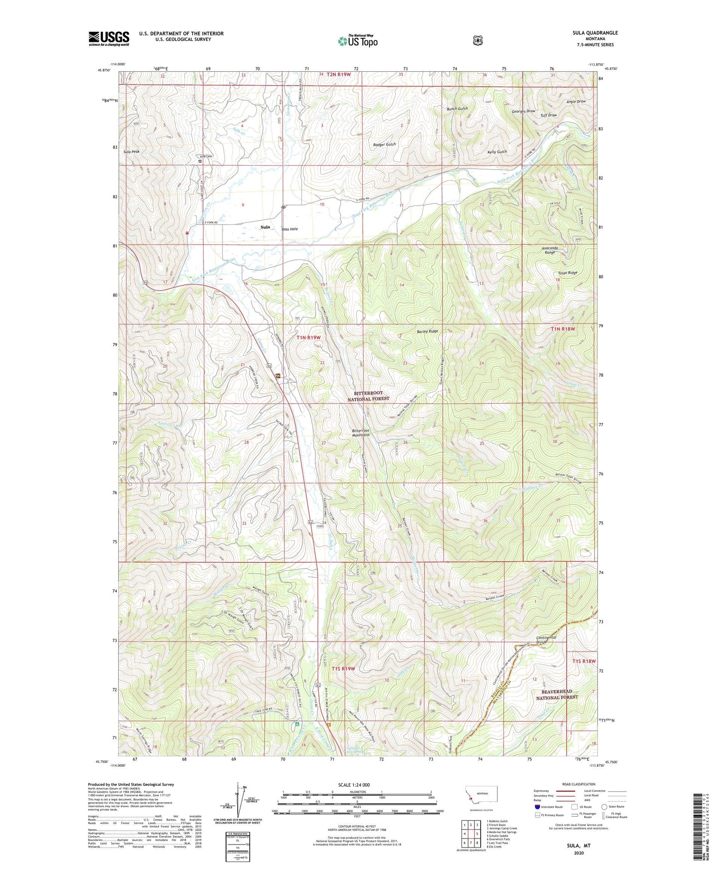
2020 topographic map quadrangle Sula in the state of Montana. Scale: 1:24000. Based on the newly updated USGS 7.5' US Topo map series, this map is in the following counties: Ravalli, Beaverhead. The map contains contour data, water features, and other items you are used to seeing on USGS maps, but also has updated roads and other features. This is the next generation of topographic maps. Printed on high-quality waterproof paper with UV fade-resistant inks.
Quads adjacent to this one:
West: Medicine Hot Springs
Northwest: Robbins Gulch
North: French Basin
Northeast: Jennings Camp Creek
East: Schultz Saddle
Southeast: Elk Creek
South: Lost Trail Pass
Southwest: Overwhich Falls
Contains the following named places: 01N19W10CBBB01 Well, 01N19W16DDAA01 Well, Andrews Creek, Angle Draw, Badger Gulch, Barley Ridge, Bitterroot Mountains, Bunch Gulch, Cameron Creek, Camp Creek, Dick Creek, Diggins Creek, East Fork Camp Creek, Georges Draw, Indian Trees Campground, Kelly Gulch, Lost Trail Hot Springs Resort, Low Saddle, Maynard Creek, Mink Creek, Praine Creek, Reimel Creek, Ross Hole, Ross Hole Historical Marker, Sula, Sula Cemetery, Sula Census Designated Place, Sula Clubhouse, Sula Creek, Sula Peak, Sula Post Office, Sula Ranger Station, Sula Rural Fire District Station 1, Sula School, Sula Store and Campground, Tolan Creek, Tuff Draw, Wallace Creek, Waugh Creek, West Fork Camp Creek