MyTopo
Sunny Slope School Montana US Topo Map
Couldn't load pickup availability
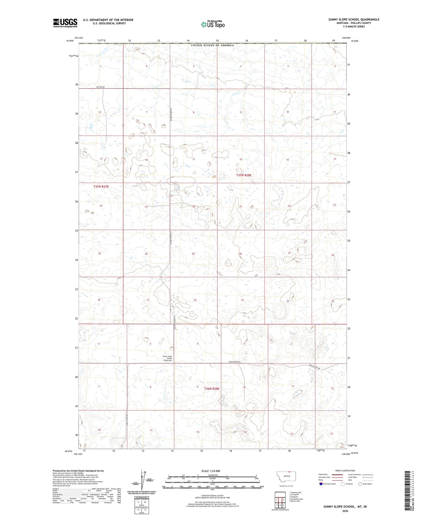
2024 topographic map quadrangle Sunny Slope School in the state of Montana. Scale: 1:24000. Based on the newly updated USGS 7.5' US Topo map series, this map is in the following counties: Phillips. The map contains contour data, water features, and other items you are used to seeing on USGS maps, but also has updated roads and other features. This is the next generation of topographic maps. Printed on high-quality waterproof paper with UV fade-resistant inks.
Quads adjacent to this one:
West: Chapman NW
East: Loring NW
Southeast: Martin Lake
South: Horseshoe Lake
Southwest: Chapman
This map covers the same area as the classic USGS quad with code o48108h1.
Contains the following named places: 36N28E05ABA_01 Well, 37N28E20AD__01 Well, Caldwell Post Office, Drydahl Dam, Hubert School, Sunny Slope School