MyTopo
Swan Lake Montana US Topo Map
Couldn't load pickup availability
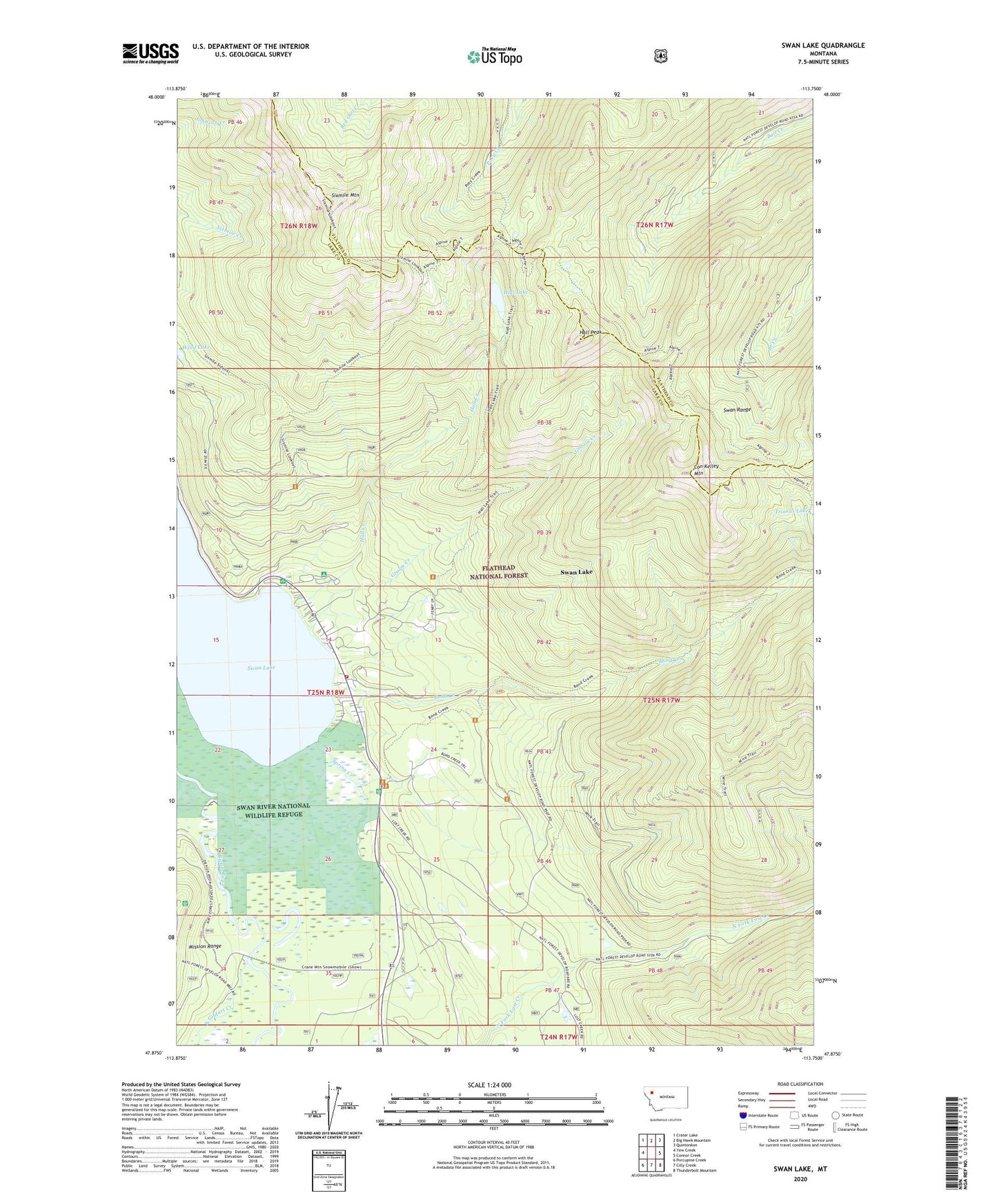
2020 topographic map quadrangle Swan Lake in the state of Montana. Scale: 1:24000. Based on the newly updated USGS 7.5' US Topo map series, this map is in the following counties: Lake, Flathead. The map contains contour data, water features, and other items you are used to seeing on USGS maps, but also has updated roads and other features. This is the next generation of topographic maps. Printed on high-quality waterproof paper with UV fade-resistant inks.
Quads adjacent to this one:
West: Yew Creek
Northwest: Crater Lake
North: Big Hawk Mountain
Northeast: Quintonkon
East: Connor Creek
Southeast: Thunderbolt Mountain
South: Cilly Creek
Southwest: Porcupine Creek
Contains the following named places: 25N18W13CDDC01 Well, 25N18W14DBB_01 Well, 25N18W35ADDA01 Well, 25N18W35DBCB01 Well, Bond Creek, Con Kelley Mountain, Gildart, Gildart Creek, Groom Creek, Hall Creek, Hall Lake, Hall Peak, Mission Lookout, Sixmile Mountain, Spring Creek, Swan Chapel, Swan Lake, Swan Lake Campground, Swan Lake Census Designated Place, Swan Lake Guard Station, Swan Lake Picnic Site, Swan Lake Post Office, Swan Lake Public Library, Swan Lake School, Swan Lake Volunteer Fire Department, Swan River National Wildlife Refuge, Wire Trail