MyTopo
The Knob Montana US Topo Map
Couldn't load pickup availability
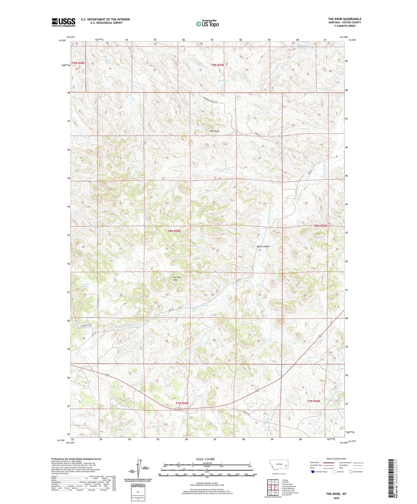
2020 topographic map quadrangle The Knob in the state of Montana. Scale: 1:24000. Based on the newly updated USGS 7.5' US Topo map series, this map is in the following counties: Custer. The map contains contour data, water features, and other items you are used to seeing on USGS maps, but also has updated roads and other features. This is the next generation of topographic maps. Printed on high-quality waterproof paper with UV fade-resistant inks.
Quads adjacent to this one:
West: Government Hill
Northwest: Kinsey
North: Shirley
Northeast: Corral Butte
East: Buck Mountain
Southeast: Locate SW
South: Government Hill SE
Southwest: Whitney Creek
Contains the following named places: 07N50E05CCBD01 Well, 08N49E05ACDA01 Well, 08N50E02DCAC01 Well, 08N50E07CD__01 Well, 08N50E08CBBD01 Well, 08N50E18BDBC01 Well, 08N50E24DCCD01 Well, Ash Creek, Black Canyon, Boyle Post Office, Grimes Creek, Ice Cave Spring, Jones Number 1 Dam, Knob Spring, McFarland Reservoir, Meadow Creek, Meadowbrook School, Sundial Dam, The Knob, The Pine Hills, Woodruff Park