MyTopo
Thoeny Montana US Topo Map
Couldn't load pickup availability
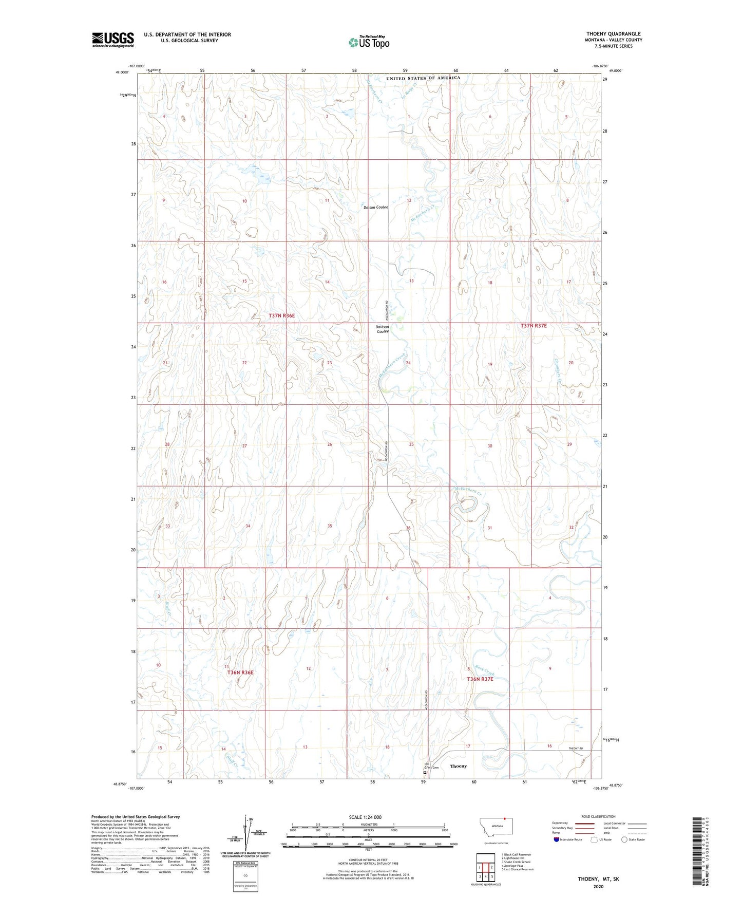
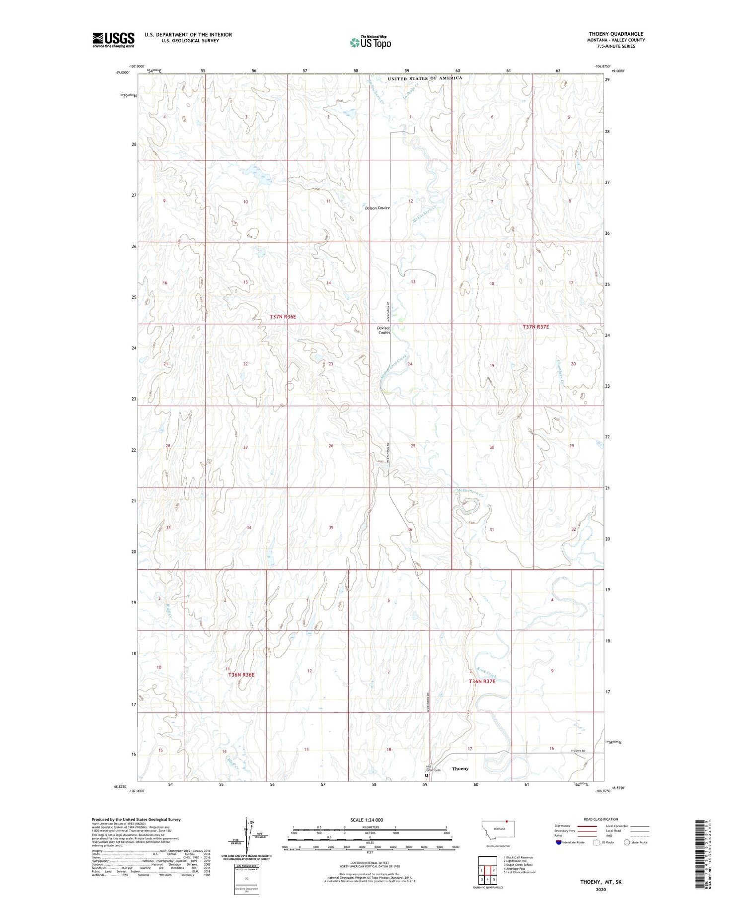
2020 topographic map quadrangle Thoeny in the state of Montana. Scale: 1:24000. Based on the newly updated USGS 7.5' US Topo map series, this map is in the following counties: Valley. The map contains contour data, water features, and other items you are used to seeing on USGS maps, but also has updated roads and other features. This is the next generation of topographic maps. Printed on high-quality waterproof paper with UV fade-resistant inks.
Quads adjacent to this one:
West: Black Calf Reservoir
East: Lighthouse Hill
Southeast: Last Chance Reservoir
South: Antelope Pass
Southwest: Snake Creek School
Contains the following named places: Boundary Post Office, Chambers Creek, Davison Coulee, Dolson Coulee, Hill Crest Cemetery, Howard School, Hunter Dam, LaBerge Creek, McEachern Creek, Rocky Ridge School, Thoeny, Thoeny Post Office, Thoeny School