MyTopo
Thompson Lakes Montana US Topo Map
Couldn't load pickup availability
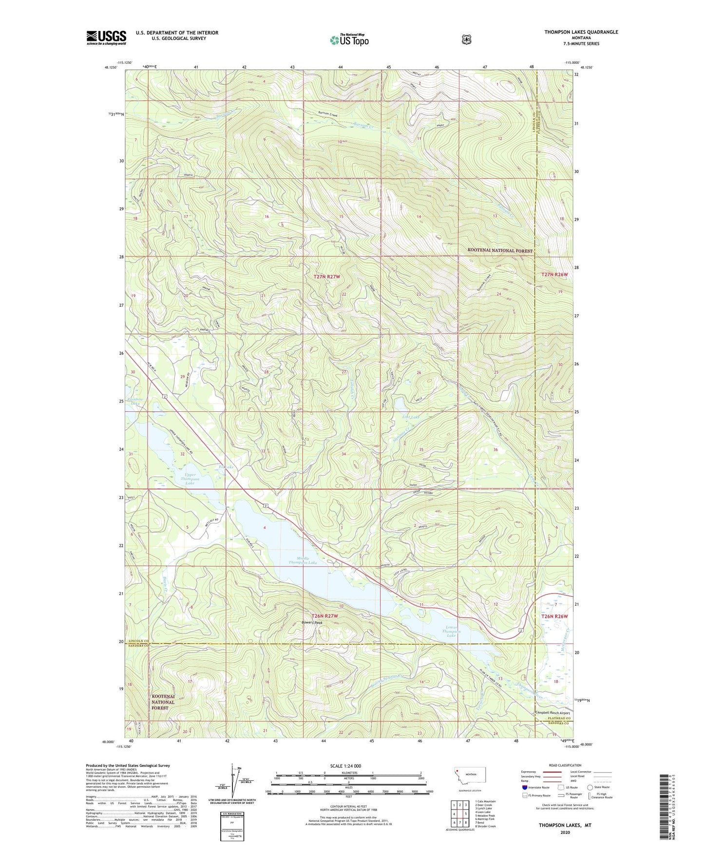
2020 topographic map quadrangle Thompson Lakes in the state of Montana. Scale: 1:24000. Based on the newly updated USGS 7.5' US Topo map series, this map is in the following counties: Lincoln, Sanders, Flathead. The map contains contour data, water features, and other items you are used to seeing on USGS maps, but also has updated roads and other features. This is the next generation of topographic maps. Printed on high-quality waterproof paper with UV fade-resistant inks.
Quads adjacent to this one:
West: Loon Lake
Northwest: Calx Mountain
North: Deer Creek
Northeast: Lynch Lake
East: Meadow Peak
Southeast: Shroder Creek
South: Bend
Southwest: Mantrap Fork
Contains the following named places: Boiling Springs Creek, Bowers Peak, Campbell Ranch Airport, Davis Creek, Eli Lake, Lang Creek, Logan Park Campground, Lost Lake, Lower Thompson Lake, Meadow Ridge Trail, Middle Thompson Lake, Rainbow Lake, Slimmer Creek, Slimmer Creek Trail, Tallulah Creek, Thompson Lakes, Tornilla Creek, Upper Thompson Lake, Yakt, Yakt Post Office