MyTopo
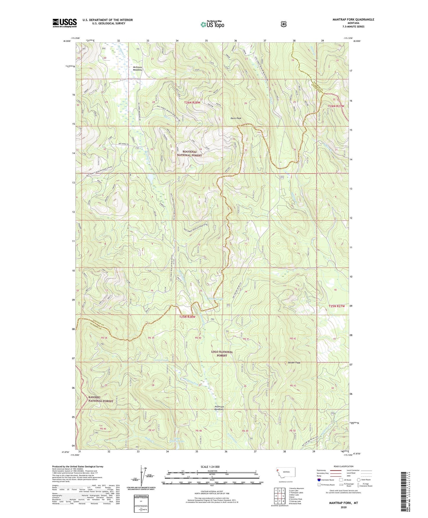
Mantrap Fork Montana US Topo Map
Couldn't load pickup availability
Also explore the Mantrap Fork Forest Service Topo of this same quad for updated USFS data
2024 topographic map quadrangle Mantrap Fork in the state of Montana. Scale: 1:24000. Based on the newly updated USGS 7.5' US Topo map series, this map is in the following counties: Lincoln, Sanders. The map contains contour data, water features, and other items you are used to seeing on USGS maps, but also has updated roads and other features. This is the next generation of topographic maps. Printed on high-quality waterproof paper with UV fade-resistant inks.
Quads adjacent to this one:
West: Miller Lake
Northwest: Kenelty Mountain
North: Loon Lake
Northeast: Thompson Lakes
East: Bend
Southeast: Richards Peak
South: Fishtrap Lake
Southwest: Vermilion Peak
This map covers the same area as the classic USGS quad with code o47115h2.
Contains the following named places: Border Peak, Crescent Lake, Davis Peak, Doe Creek, Jefferson Meadows, Mantrap Fork, McGilla Gorilla Number 50 Dam, McGinnis Meadows, Sales Mine, Sales Prospect, Upper Fishtrap Lake, Whitney Lake