MyTopo
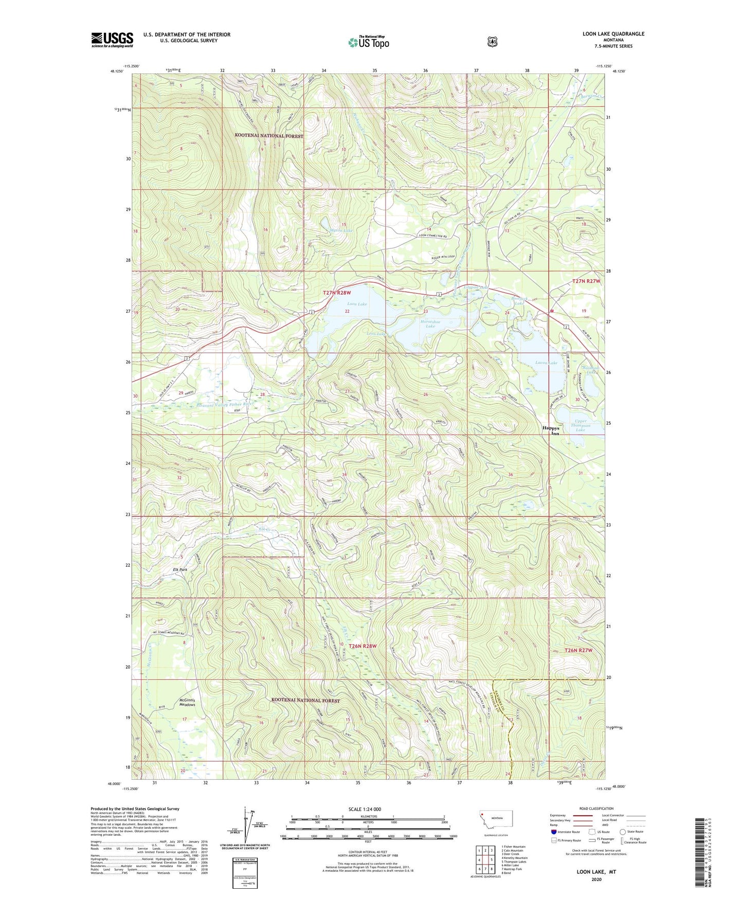
Loon Lake Montana US Topo Map
Couldn't load pickup availability
Also explore the Loon Lake Forest Service Topo of this same quad for updated USFS data
2024 topographic map quadrangle Loon Lake in the state of Montana. Scale: 1:24000. Based on the newly updated USGS 7.5' US Topo map series, this map is in the following counties: Lincoln, Sanders. The map contains contour data, water features, and other items you are used to seeing on USGS maps, but also has updated roads and other features. This is the next generation of topographic maps. Printed on high-quality waterproof paper with UV fade-resistant inks.
Quads adjacent to this one:
West: Kenelty Mountain
Northwest: Fisher Mountain
North: Calx Mountain
Northeast: Deer Creek
East: Thompson Lakes
Southeast: Bend
South: Mantrap Fork
Southwest: Miller Lake
This map covers the same area as the classic USGS quad with code o48115a2.
Contains the following named places: Barnum Creek, Bootjack Lake, Crystal Lake, Elk Creek, Elk Park, Fisher River Valley Fire and Rescue Battalion 1, Happys Inn, Happys Inn Census Designated Place, Horseshoe Lake, Lavon Lake, Leon Lake, Lilypad Lake, Little Loon Lake, Loon Lake, Loon Lake Mine, Myron Lake, Potter Mine, Rainbow Lake, Sipes Creek, Thompson Chain of Lakes Fishing Access Site, Wabuno Creek