MyTopo
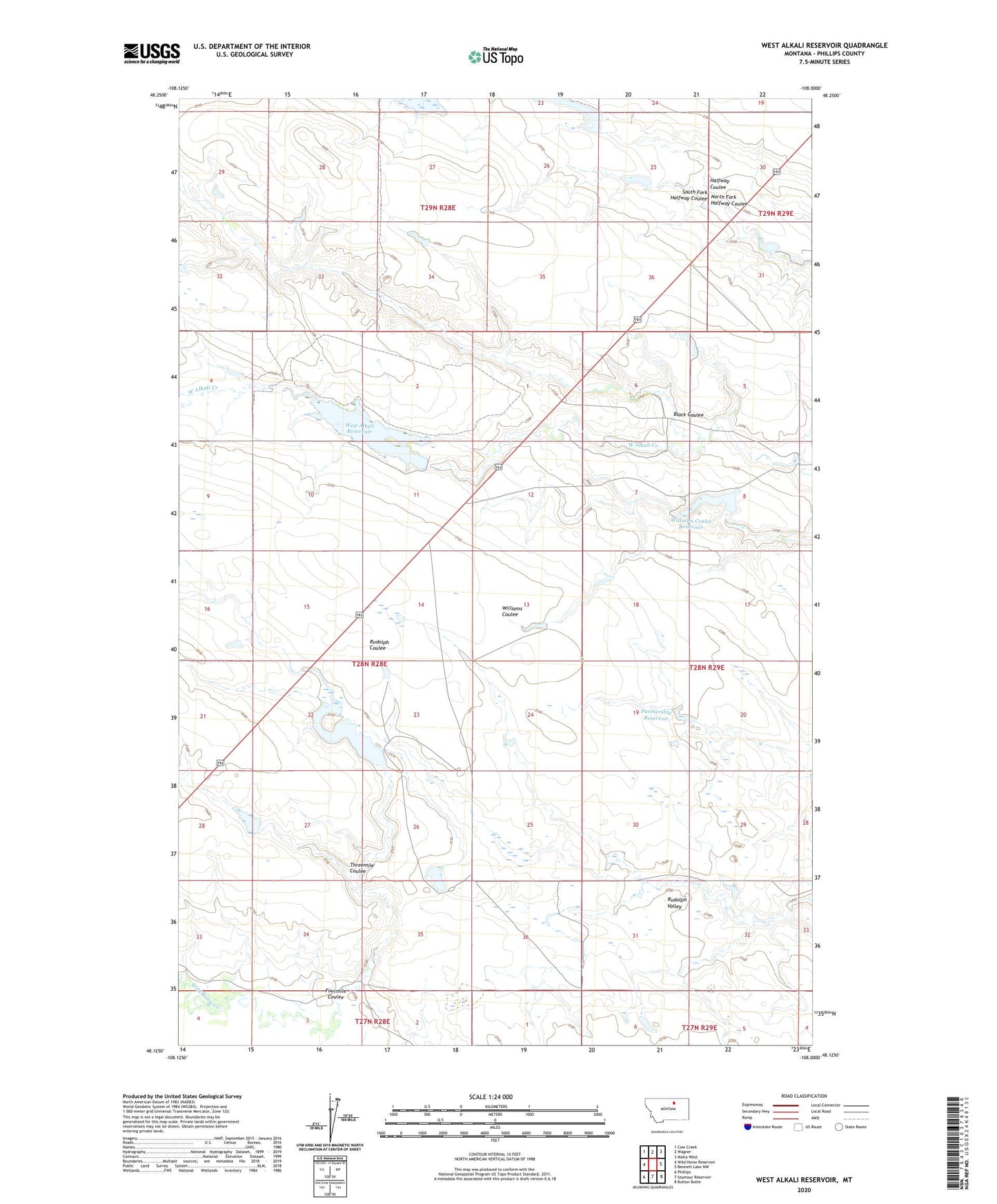
West Alkali Reservoir Montana US Topo Map
Couldn't load pickup availability
2024 topographic map quadrangle West Alkali Reservoir in the state of Montana. Scale: 1:24000. Based on the newly updated USGS 7.5' US Topo map series, this map is in the following counties: Phillips. The map contains contour data, water features, and other items you are used to seeing on USGS maps, but also has updated roads and other features. This is the next generation of topographic maps. Printed on high-quality waterproof paper with UV fade-resistant inks.
Quads adjacent to this one:
West: Wild Horse Reservoir
Northwest: Cow Creek
North: Wagner
Northeast: Malta West
East: Bennett Lake NW
Southeast: Button Butte
South: Seymour Reservoir
Southwest: Phillips
This map covers the same area as the classic USGS quad with code o48108b1.
Contains the following named places: Alkali Post Office, Black Coulee, D Drum Dam, Fourmile Coulee, Halvor Number 1 Dam, McIntire School, Meeting Place Dam, Mitchell One Dam, MRLCA Number 1 Dam, MRLCA Number 2 Dam, North Fork Halfway Coulee, Partnership Reservoir, PR-161 Dam, PR-95 Dam, Reservoir Number One Hundred Sixty-one, South Fork Halfway Coulee, Threemile Coulee, Tuttle Dam, Tuttle School, W B Black Dam, West Alkali Reservoir, West Alkali Reservoir Dam, Williams Coulee Reservoir